
File:Yuma County Incorporated and Unincorporated areas Yuma highlighted.svg

Dimension de iste previsualisation PNG de iste file SVG: 520 × 600 pixels. Altere resolutiones: 208 × 240 pixels | 416 × 480 pixels | 666 × 768 pixels | 887 × 1 024 pixels | 1 775 × 2 048 pixels | 650 × 750 pixels.
File original (File SVG, dimensiones nominal: 650 × 750 pixels, grandor del file: 60 KB)
Summario
| Description |
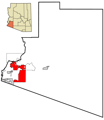
This map shows the incorporated areas and unincorporated areas in Yuma County, Arizona. Data for the borders and locations are based on maps from the Yuma County DDS Mapping Services, US Census Bureau TIGER Map Server, and ITCA Map of Tribal Homelands in Arizona.
|
| Data | |
| Origine | My own work, based on public domain information |
| Autor | Ixnayonthetimmay |
| Permission (Reuso de iste file) |
All rights not reserved. See below. |
| Altere versiones | See Category:Maps of Yuma County, Arizona for other versions of this image. |
Licentia
| Io, titular del derecto de autor sur iste obra, libera iste obra al dominio public. Isto vale in tote le mundo. In alcun paises isto pote non esser legalmente possibile. In tal caso: Io concede a omnes le derecto de usar iste obra pro non importa qual fin, sin conditiones, a minus que tal conditiones sia requirite per lege. |
Historia del file
Clicca sur un data/hora pro vider le file como appareva a ille tempore.
| Data/Hora | Miniatura | Dimensiones | Usator | Commento | |
|---|---|---|---|---|---|
| actual | 20:25, 22 martio 2007 | | 650 × 750 (60 KB) | Ixnayonthetimmay | {{Information |Description=This map shows the incorporated areas and unincorporated areas in Yuma County, Arizona. Yuma is highlighted in r |
Uso de iste file
Le sequente pagina usa iste file:
Uso global de iste file
Le altere wikis sequente usa iste imagine:
- Uso in ar.wikipedia.org
- Uso in arz.wikipedia.org
- Uso in ca.wikipedia.org
- Uso in ceb.wikipedia.org
- Uso in cy.wikipedia.org
- Uso in de.wikipedia.org
- Uso in el.wikipedia.org
- Uso in eo.wikipedia.org
- Uso in et.wikipedia.org
- Uso in eu.wikipedia.org
- Uso in fa.wikipedia.org
- Uso in fi.wikipedia.org
- Uso in fr.wikipedia.org
- Uso in ga.wikipedia.org
- Uso in he.wikipedia.org
- Uso in ht.wikipedia.org
- Uso in hu.wikipedia.org
- Uso in id.wikipedia.org
- Uso in ja.wikipedia.org
- Uso in mrj.wikipedia.org
- Uso in pt.wikipedia.org
- Uso in ro.wikipedia.org
- Uso in sco.wikipedia.org
- Uso in sr.wikipedia.org
- Uso in sw.wikipedia.org
- Uso in tr.wikipedia.org
- Uso in tt.wikipedia.org
- Uso in ur.wikipedia.org
- Uso in vo.wikipedia.org
- Uso in www.wikidata.org
- Uso in zh-min-nan.wikipedia.org
- Uso in zh.wikipedia.org