
File:Tasmania in Australia map.png
Non disponibile in resolution plus alte.
Tasmania_in_Australia_map.png (200 × 186 pixels, dimension del file: 11 KB, typo MIME: image/png)
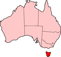
Localization of Tasmania in Australia

|
Le permission es concedite de copiar, distribuer e/o modificar iste documento sub le conditiones del Licentia GNU pro Documentation Libere, Version 1.2 o omne version plus recente publicate per le Fundation pro Software Libere; sin Sectiones Invariabile, sin Textos de Copertura Frontal e sin Textos de Copertura Posterior. Un copia del licentia es includite in le section titulate Licentia GNU pro Documentation Libere. |
| Iste file es disponibile sub le licentia Creative Commons Attribution-CompartiSimile 3.0 Non-localisate. | ||
| ||
| Iste etiquetta de licentia esseva addite a iste file como parte del actualisation del licentia GFDL. |

|
File:Tasmania in Australia.svg is a vector version of this file. It should be used in place of this PNG file when not inferior.
File:Tasmania in Australia map.png → File:Tasmania in Australia.svg
For more information, see Help:SVG. |
 |
History on English Wikipedia
- (delete all) (current) 23:20, 22 February 2004 Morwen (Talk | contribs | block) 200×186 11 KB
- (delete this) (revert) 08:45, 10 May 2003 Tim Starling (Talk | contribs | block) 200×181 4 KB Created by me based on Geoscience Australia data
Historia del file
Clicca sur un data/hora pro vider le file como appareva a ille tempore.
| Data/Hora | Miniatura | Dimensiones | Usator | Commento | |
|---|---|---|---|---|---|
| actual | 15:08, 12 decembre 2004 | | 200 × 186 (11 KB) | Mschlindwein | Localization of Tasmania in Australia |
Uso de iste file
Il non ha paginas que usa iste file.
Uso global de iste file
Le altere wikis sequente usa iste imagine:
- Uso in en.wikipedia.org
- Coat of arms of Tasmania
- List of highways in Tasmania
- James Boag's Premium
- Tasmanian Conservation Trust
- Butlers Gorge Power Station
- Tasmania 40° South
- Colonial Secretary of Tasmania
- Office of the Tasmanian Economic Regulator
- Anthony Fenn Kemp
- Tasmanian Ports Corporation
- Agfest
- Mona Foma
- William Collins (colonist)
- Grecian (1824 ship)
- Cygnet Folk Festival
- Tasmanian Freight Equalisation Scheme
- Template:Tasmania-stub
- Bulbine crassa
- Currie Lighthouse
- Goose Island Lighthouse
- Electoral division of Westmorland
- Lune River, Tasmania
- Tasmanian University Football Club
- 2014 Tasmanian Legislative Council periodic election
- Tasmanian Electoral Commission
- Hope and Anchor Tavern
- Gormanston railway station, Tasmania
- 2015 Tasmanian Legislative Council periodic election
- Tasmanian Central Highlands
- Tasmanian Northern Midlands
- Tasmanian Northern Slopes
- Tasmanian West
- Tasmanian South East
- Tasmanian Southern Ranges
- King bioregion
- Ben Lomond bioregion
- Nieterana Power Station
- Deal Island Lighthouse
- Furneaux bioregion
- Tasmanian Government Personal Information Card
- 2018 Hobart floods
- Patterdale and Nile Farm
- Tasdance
- Lea Tree
- Solicitor-General of Tasmania
- Uso in hif.wikipedia.org
- Uso in hu.wikipedia.org
- Uso in id.wikipedia.org
- Uso in ja.wikipedia.org
- Uso in nv.wikipedia.org
Vider altere usos global de iste file.