
File:Schwarzsee.jpg
Dimension de iste previsualisation: 800 × 600 pixels.Altere resolutiones: 320 × 240 pixels | 640 × 480 pixels | 1 024 × 768 pixels | 1 280 × 960 pixels | 2 048 × 1 536 pixels.
File original (2 048 × 1 536 pixels, dimension del file: 1,27 MB, typo MIME: image/jpeg)
| Description |
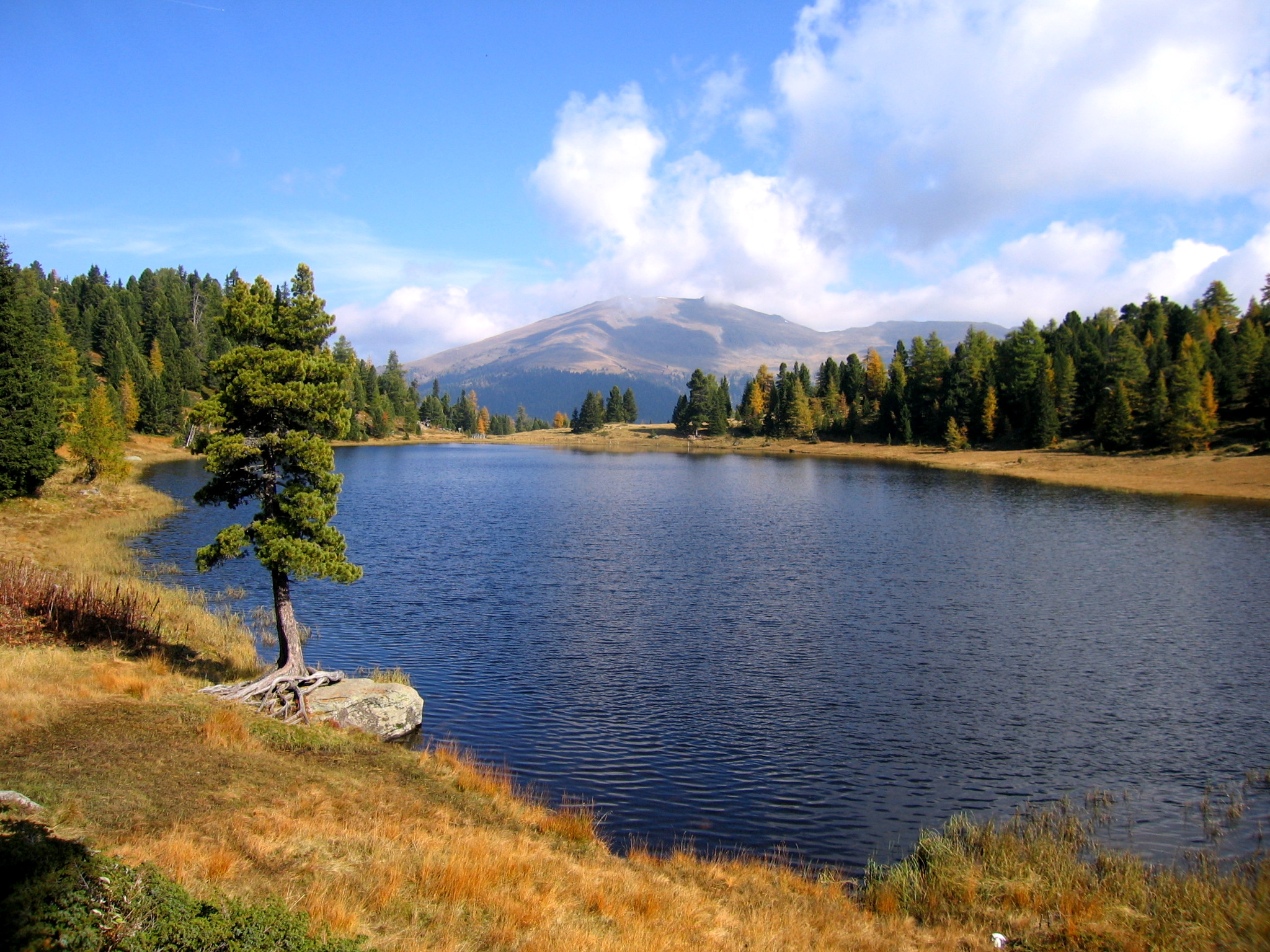
English: Lake Schwarzsee in the Nockberge mountain range near Turracher Höhe at the border between Carinthia and Styria / Austria / EU. The Styrian mountains in the background are Eisenhut and Wintertalernock.
Deutsch: Der Schwarzsee auf der Turracher Höhe im an der Grenze zwischen den österreichischen Bundesländern Kärnten und Steiermark. Die Berge im Hintergrund liegen in der Steiermark und sind der Eisenhut (2.441 m) und rechts der Wintertalernock (2.394 m). Im Vordergrund eine gebietstypische Zirbe, rechts und links vom See Zirben und Lärchen.
Français : Schwarzsee (lac noir), dans les Alpes autrichiennes. |
| Data | |
| Origine | Obra proprie |
| Autor | Kmarka |
| Permission (Reuso de iste file) |
GFDL |
| Camera location | | View this and other nearby images on: OpenStreetMap |
|---|
Io, titular del derecto de autor sur iste obra, declara de publicar lo sub le sequente licentias:

|
Le permission es concedite de copiar, distribuer e/o modificar iste documento sub le conditiones del Licentia GNU pro Documentation Libere, Version 1.2 o omne version plus recente publicate per le Fundation pro Software Libere; sin Sectiones Invariabile, sin Textos de Copertura Frontal e sin Textos de Copertura Posterior. Un copia del licentia es includite in le section titulate Licentia GNU pro Documentation Libere. |
| Iste file es disponibile sub le licentia Creative Commons Attribution-CompartiSimile 3.0 Non-localisate. | ||
| ||
| Iste etiquetta de licentia esseva addite a iste file como parte del actualisation del licentia GFDL. |
Tu pote seliger le licentia de tu preferentia.
|

This image was selected as picture of the day on Wikimedia Commons for 10 March 2007. It was captioned as follows: English: Turracher Schwarzsee (Austria) Other languages:
Čeština: Jezero Turracher Schwarzsee Rakousko Cymraeg: Turracher Schwarzsee (Llyn Du Turrach), Awstria. Deutsch: Turracher Schwarzsee Turracher Höhe English: Turracher Schwarzsee (Austria) Español: Turracher Schwarzsee (Austria) Esperanto: Schwarzsee (Aŭstrio) Français : Schwarzsee (Autriche). Italiano: Schwarzsee (Austria) Magyar: Turracher Schwarzsee (Ausztria) Nederlands: Turachse meer in Oostenrijk Polski: Turracher Schwarzsee w Austrii. Sicilianu: Schwarzsee (Àustria) Slovenčina: Turracher Schwarzsee (Rakúsko) Suomi: Turracher Schwarzsee -vuoristojärvi Itävallassa Svenska: Schwarzsee (Österrike). Türkçe: Schwarzsee (Avusturya). Қазақша: Шварцзее көлі (Аустрия) Українська: Озеро Туррахер Шварцзее (Австрія) 日本語: トゥーラッハ湖 (オーストリア) |
Historia del file
Clicca sur un data/hora pro vider le file como appareva a ille tempore.
| Data/Hora | Miniatura | Dimensiones | Usator | Commento | |
|---|---|---|---|---|---|
| actual | 13:04, 8 julio 2006 | | 2 048 × 1 536 (1,27 MB) | Kmarka | Schwarzsee Turracher HöheCategory:Landschaft |
Uso de iste file
Le sequente pagina usa iste file:
Uso global de iste file
Le altere wikis sequente usa iste imagine:
- Uso in ba.wikipedia.org
- Uso in de.wikipedia.org
- Uso in el.wikipedia.org
- Uso in en.wikipedia.org
- Uso in es.wikipedia.org
- Uso in et.wikipedia.org
- Uso in fr.wikipedia.org
- Uso in fr.wiktionary.org
- Uso in he.wikipedia.org
- Uso in hu.wikipedia.org
- Uso in it.wikipedia.org
- Uso in kk.wikipedia.org
- Uso in ko.wikipedia.org
- Uso in os.wikipedia.org
- Uso in pl.wikipedia.org
- Uso in pt.wikipedia.org
- Uso in pt.wiktionary.org
- Uso in ru.wikipedia.org
- Uso in ru.wikinews.org
- Uso in sg.wiktionary.org
- Uso in sr.wikipedia.org
Vider altere usos global de iste file.