
File:Relief Map of Czech Republic.png

Dimension de iste previsualisation: 800 × 486 pixels.Altere resolutiones: 320 × 195 pixels | 640 × 389 pixels | 1 000 × 608 pixels.
File original (1 000 × 608 pixels, dimension del file: 866 KB, typo MIME: image/png)
Summario
| Description |
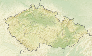
English: Relief map of the Czech Republic
Equirectangular projection, N/S stretching 150 %. Geographic limits of the map:
|
| Data | |
| Origine |
|
| Autor | derivative work Виктор_В |
Licentia
Iste file es disponibile sub le licentia Creative Commons Attribution-CompartiSimile 3.0 Non-localisate.
- Tu es libere:
- de condivider – de copiar, distribuer e transmitter le obra
- de remixar – de adaptar le obra
- Sub le sequente conditiones:
- attribution – Tu debe dar information appropriate sur le autor, fornir un ligamine al licentia, e indicar si modificationes ha essite apportate. Tu pote facer lo de qualcunque maniera rationabile, ma non in alcun modo que suggere que le licentiator approba te o tu uso del obra.
- condivider equalmente – Si tu altera, transforma o disveloppa le material, tu debe distribuer tu contributiones sub un licentia identic o compatibile con le original.
Historia del file
Clicca sur un data/hora pro vider le file como appareva a ille tempore.
| Data/Hora | Miniatura | Dimensiones | Usator | Commento | |
|---|---|---|---|---|---|
| actual | 08:37, 11 januario 2021 | | 1 000 × 608 (866 KB) | ThecentreCZ | Reverted to version as of 11:53, 28 August 2010 (UTC) V Ústavním pořádku České republiky nemají zemské hranice žádné ukotvení a jsou jen přežitkem |
| 22:48, 10 januario 2021 |  | 1 000 × 608 (780 KB) | Osidor | přidány zemské hranice (důvod: na mapě jsou užitečné nejméně stejně jako ty krajské [spíše však více]) | |
| 11:53, 28 augusto 2010 |  | 1 000 × 608 (866 KB) | Виктор В | == {{int:filedesc}} == {{Information |Description={{en|Location map of the Czech Republic}} Equirectangular projection, N/S stretching 150 %. Geographic limits of the map: * N: 51.3° N * S: 48.3° N * W: 11.8° E * O: 19.2° |
Uso de iste file
Il non ha paginas que usa iste file.
Uso global de iste file
Le altere wikis sequente usa iste imagine:
- Uso in als.wikipedia.org
- Uso in arz.wikipedia.org
- Uso in ast.wikipedia.org
- Uso in azb.wikipedia.org
- Uso in az.wikipedia.org
- Uso in ba.wikipedia.org
- Uso in be-tarask.wikipedia.org
- Uso in be.wikipedia.org
- Uso in bg.wikipedia.org
Vider altere usos global de iste file.