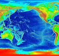
File:Pacific elevation.jpg

Dimension de iste previsualisation: 632 × 599 pixels.Altere resolutiones: 253 × 240 pixels | 506 × 480 pixels | 810 × 768 pixels | 1 080 × 1 024 pixels | 2 500 × 2 370 pixels.
File original (2 500 × 2 370 pixels, dimension del file: 899 KB, typo MIME: image/jpeg)
Historia del file
Clicca sur un data/hora pro vider le file como appareva a ille tempore.
| Data/Hora | Miniatura | Dimensiones | Usator | Commento | |
|---|---|---|---|---|---|
| actual | 03:41, 7 martio 2006 |  | 2 500 × 2 370 (899 KB) | Interiot~commonswiki | Elevation of the Pacific ocean Source: http://www.ngdc.noaa.gov/mgg/image/2minrelief.html |
Uso de iste file
Le sequente pagina usa iste file:
Uso global de iste file
Le altere wikis sequente usa iste imagine:
- Uso in als.wikipedia.org
- Uso in ang.wikipedia.org
- Uso in ar.wikipedia.org
- Uso in avk.wikipedia.org
- Uso in azb.wikipedia.org
- Uso in az.wikipedia.org
- Uso in bat-smg.wikipedia.org
- Uso in be.wikipedia.org
- Uso in bg.wikipedia.org
- Uso in bn.wikipedia.org
- Uso in bs.wikipedia.org
- Uso in ca.wikipedia.org
- Uso in ceb.wikipedia.org
- Uso in chr.wikipedia.org
- Uso in crh.wikipedia.org
- Uso in cs.wikipedia.org
- Uso in da.wikipedia.org
- Uso in de.wikipedia.org
- Uso in de.wiktionary.org
- Uso in dsb.wikipedia.org
- Uso in en.wikipedia.org
- Uso in en.wikibooks.org
- Uso in es.wikipedia.org
- Uso in et.wikipedia.org
- Uso in ext.wikipedia.org
- Uso in fa.wikipedia.org
- Uso in fiu-vro.wikipedia.org
- Uso in fi.wikipedia.org
- Uso in fj.wikipedia.org
- Uso in frr.wikipedia.org
- Uso in fy.wikipedia.org
- Uso in gan.wikipedia.org
- Uso in gd.wikipedia.org
- Uso in gl.wikipedia.org
- Uso in he.wikipedia.org
- Uso in hif.wikipedia.org
- Uso in hr.wikipedia.org
- Uso in hsb.wikipedia.org
Vider altere usos global de iste file.

