
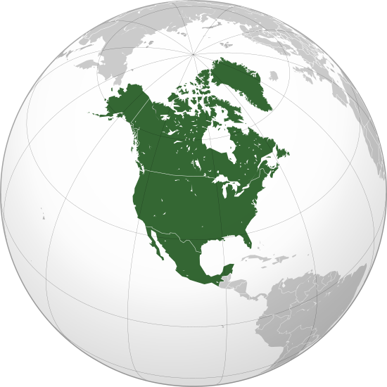
File:North America (orthographic projection).svg

Dimension de iste previsualisation PNG de iste file SVG: 550 × 550 pixels. Altere resolutiones: 240 × 240 pixels | 480 × 480 pixels | 768 × 768 pixels | 1 024 × 1 024 pixels | 2 048 × 2 048 pixels.
File original (File SVG, dimensiones nominal: 550 × 550 pixels, grandor del file: 457 KB)
Summario
| Description |
বাংলা: ওত্তরী আমেরিকার অর্থোগ্রাফিক মানচিত্র हिन्दी: उत्तरी अमेरिका का लेखनप्रक्षेपीय मानचित्र English: North America (orthographic projection) |
||||
| Data | |||||
| Origine |
Obra proprie (Original text: Own work,)
|
||||
| Autor | Heraldry | ||||
| Permission (Reuso de iste file) |
|
||||
| Altere versiones |
Derivative works of this file: BK North America (orthographic projection).png .svg) |
||||
| SVG genesis | SVG watermarked with invisible embedded text. |

.svg)
.svg)
.svg)
.svg)
.svg)
.svg)
.svg)
.svg)
.svg)
.svg)
.svg)
.svg)
.svg)
.svg)
.svg)
.svg)
.svg)
.svg)
.svg)
.svg)
.svg)
.svg)
.svg)
.svg)
.svg)
.svg)
.svg)
.svg)
.svg)
.svg)
.svg)
.svg)
.svg)
.svg)
.svg)
.svg)
.svg)
.svg)
.svg)
.svg)
.svg)
.svg)
.svg)
.svg)
.svg)
.svg)
.svg)
.svg)
.svg)
.svg)
.svg)
.svg)
.svg)
.svg)
.svg)
.svg)
.svg)
.svg)
.svg)
.svg)
.svg)
.svg)
.svg)
.svg)
.svg)
.svg)
.svg)
.svg)
.svg)
.svg)
.svg)
.svg)
.svg)

.svg)

.svg)

.svg)
.svg)
.svg)
.svg)
.svg)
.svg)
.svg)


.svg)
.svg)
.svg)
.svg)
.svg)
.svg)
.svg)

.svg)
.svg)
.svg)
.svg)
.svg)
.svg)
.svg)
.svg)
.svg)

.svg)
.svg)
.svg)
.svg)
.svg)
.svg)
.svg)
_without_national_boundaries.svg)
.svg)
.svg)
.svg)
.svg)
.svg)
.svg)

.svg)
.svg)
.png)
.svg)
.svg)
.svg)
.svg)

.svg)
.svg)
.svg)
.svg)
.svg)
.svg)
.svg)
.svg)
.svg)
.svg)
.svg)

.svg)
.svg)
.svg)
.svg)
.svg)
.svg)
.svg)
.svg)
.svg)

.svg)
.svg)

.svg)
.svg)
.svg)
.svg)
.svg)
.svg)
.svg)
.svg)
.svg)
.svg)
.svg)
.svg)
.svg)
.svg)
.svg)
.svg)
.svg)
.svg)
.svg)
.svg)
.svg)
.svg)
.svg)
.svg)
.svg)
.svg)
.svg)
_-_Crimea_disputed.svg)
.svg)
.svg)
.svg)
.svg)
.svg)
.svg)
.svg)
.svg)
.svg)
.svg)
.svg)
_political.svg)
.svg)
.svg)
.svg)
.svg)
_-_Crimea_disputed_-_no_borders.svg)
.svg)
.svg)
.svg)
.svg)
.svg)
.svg)
.svg)
.svg)
.svg)
.svg)
.svg)

.svg)
.svg)
.svg)

.png)
.svg)
.svg)
.svg)
.svg)
.svg)
.svg)
.svg)
.svg)
.svg)
.svg)
.svg)
.svg)
.svg)
.svg)
.svg)
.svg)
.svg)
.svg)
.svg)
.svg)
.svg)
.svg)
.svg)
.svg)
.svg)
.svg)
.svg)
.svg)
.svg)
.svg)
.svg)
.svg)
.svg)
.svg)
.png)
.svg)
.svg)
.svg)
_(orthographic_projection).png)
.svg)
.png)
.svg)
.svg)
.svg)
.svg)
Licentia
Io, titular del derecto de autor sur iste obra, declara de publicar lo sub le sequente licentia:

|
Le permission es concedite de copiar, distribuer e/o modificar iste documento sub le conditiones del Licentia GNU pro Documentation Libere, Version 1.2 o omne version plus recente publicate per le Fundation pro Software Libere; sin Sectiones Invariabile, sin Textos de Copertura Frontal e sin Textos de Copertura Posterior. Un copia del licentia es includite in le section titulate Licentia GNU pro Documentation Libere. |
| Iste file es disponibile sub le licentia Creative Commons Attribution-CompartiSimile 3.0 Non-localisate. | ||
| ||
| Iste etiquetta de licentia esseva addite a iste file como parte del actualisation del licentia GFDL. |
Historia del file
Clicca sur un data/hora pro vider le file como appareva a ille tempore.
| Data/Hora | Miniatura | Dimensiones | Usator | Commento | |
|---|---|---|---|---|---|
| actual | 08:38, 27 junio 2023 | | 550 × 550 (457 KB) | Lasunncty | Reverted to version as of 16:06, 17 January 2023 (UTC) duplicate |
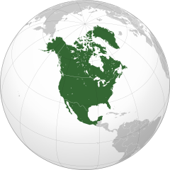
| 19:49, 25 junio 2023 |  | 550 × 550 (455 KB) | HelpfulHens | Central America and the Caribbean are all part of North America | |
| 16:06, 17 januario 2023 |  | 550 × 550 (457 KB) | Bultro | the map with all Mexico and Caribbean is file:Location North America.svg. We just also want THIS map. You may ask to rename it | |
| 22:28, 8 januario 2023 |  | 550 × 550 (414 KB) | HelpfulHens | Added Central America and the Caribbean | |
| 22:16, 8 januario 2023 |  | 550 × 550 (457 KB) | Bultro | the map without Mexico is File:Northern America (orthographic projection).svg | |
| 17:33, 7 januario 2023 |  | 550 × 550 (676 KB) | HelpfulHens | Removed Mexico | |
| 16:42, 7 septembre 2009 |  | 550 × 550 (457 KB) | TownDown | sized according | |
| 08:52, 10 julio 2009 |  | 541 × 541 (457 KB) | PuebloUnited | details | |
| 08:23, 25 junio 2009 |  | 541 × 541 (458 KB) | TownDown | {{Information |Description={{en|1=North America}} |Source=trabajo propio (own work) |Author=TownDown |Date= |Permission= |other_versions= }} <!--{{ImageUpload|full}}--> Category:Orthographic projections |
Uso de iste file
Il non ha paginas que usa iste file.
Uso global de iste file
Le altere wikis sequente usa iste imagine:
- Uso in af.wikipedia.org
- Noord-Amerika
- Verenigde State van Amerika
- Kaaimanseilande
- Kanada
- Ottawa
- Groenland
- Sint Pierre en Miquelon
- Hoofstad
- Lys van hoofstede
- Meksiko
- Aruba
- Oranjestad
- Kategorie:Lande in Noord-Amerika
- Sint Maarten
- Kuba
- Washington, D.C.
- Lys van lande
- Puerto Rico
- Havana
- Costa Rica
- Honduras
- Belize
- Guatemala
- El Salvador
- Nicaragua
- Panama
- Jamaika
- St. Lucia
- San José, Costa Rica
- Tegucigalpa
- San Salvador
- Castries
- Barbados
- Lys van nasionale leuses
- Sjabloon:Lande van Noord-Amerika
- Sjabloon:Lande van Amerika
- Clipperton
- Dominikaanse Republiek
- Meksikostad
- Amerikas
- Sjabloon:Hoofstede in Noord-Amerika
- Bahamas
- Haïti
- Antigua en Barbuda
- Trinidad en Tobago
- Dominica
- Grenada
- St. Kitts en Nevis
- St. Vincent en die Grenadine
- Belmopan
Vider altere usos global de iste file.
.svg)
.svg)