
File:Map of the Viceroyalty of New Spain.svg

Dimension de iste previsualisation PNG de iste file SVG: 800 × 407 pixels. Altere resolutiones: 320 × 163 pixels | 640 × 325 pixels | 1 024 × 520 pixels | 1 280 × 650 pixels | 2 560 × 1 301 pixels | 3 121 × 1 586 pixels.
File original (File SVG, dimensiones nominal: 3 121 × 1 586 pixels, grandor del file: 1,67 MB)
Summario
| Description |
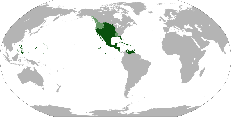
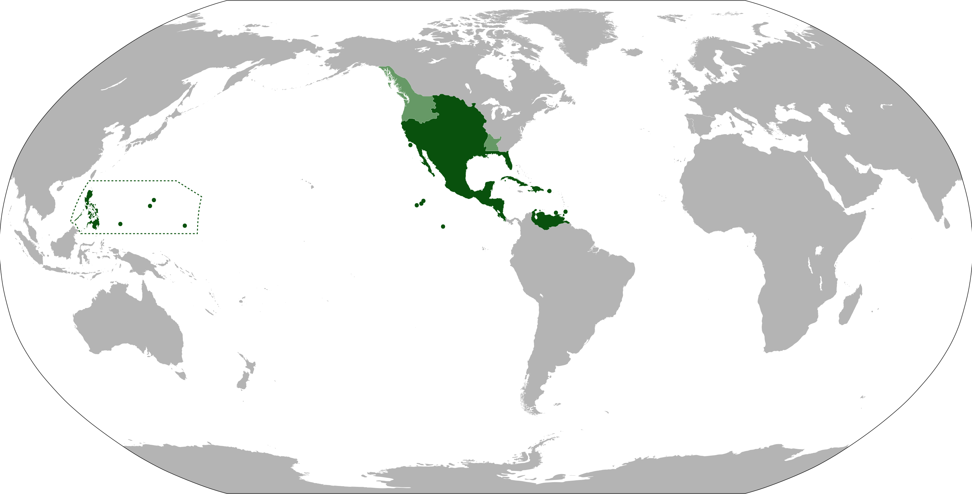
English: Anachronistic map of New Spain, built from Image:New_Spain.png by myself and released on multi-licence (GFDL and CC-BY 2.5). This image includes the territory of Louisiana, annexed to the Spanish Empire in 1763 after the Seven Years' War, but then given back to France in 1801. The areas in light green were territories claimed by Spain. |
| Data | |
| Origine | |
| Autor | Eddo |
Licentia
Io, titular del derecto de autor sur iste obra, declara de publicar lo sub le sequente licentias:
Iste file es disponibile sub le licentia Creative Commons Attribution-CompartiSimile 3.0 Non-localisate.
- Tu es libere:
- de condivider – de copiar, distribuer e transmitter le obra
- de remixar – de adaptar le obra
- Sub le sequente conditiones:
- attribution – Tu debe dar information appropriate sur le autor, fornir un ligamine al licentia, e indicar si modificationes ha essite apportate. Tu pote facer lo de qualcunque maniera rationabile, ma non in alcun modo que suggere que le licentiator approba te o tu uso del obra.
- condivider equalmente – Si tu altera, transforma o disveloppa le material, tu debe distribuer tu contributiones sub un licentia identic o compatibile con le original.

|
Le permission es concedite de copiar, distribuer e/o modificar iste documento sub le conditiones del Licentia GNU pro Documentation Libere, Version 1.2 o omne version plus recente publicate per le Fundation pro Software Libere; sin Sectiones Invariabile, sin Textos de Copertura Frontal e sin Textos de Copertura Posterior. Un copia del licentia es includite in le section titulate Licentia GNU pro Documentation Libere. |
Tu pote seliger le licentia de tu preferentia.
Historia del file
Clicca sur un data/hora pro vider le file como appareva a ille tempore.
| Data/Hora | Miniatura | Dimensiones | Usator | Commento | |
|---|---|---|---|---|---|
| actual | 11:09, 15 septembre 2012 | | 3 121 × 1 586 (1,67 MB) | Milenioscuro | cambio la proyeccion, corrijo las fronteras de la Luisiana española, añado linderos de la capitanía general de las Filipinas |
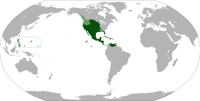
| 07:26, 6 augusto 2012 |  | 853 × 433 (1,5 MB) | Unukalhai | La Capitanía General de Venezuela estuvo bajo jurisdicción de la Real Audiencia de Santo Domingo, y ésta a su vez, del Virreinato de Nueva España. | |
| 00:48, 13 junio 2011 |  | 853 × 433 (1,49 MB) | Durero | More islands: the Caroline, the Marianas, Palau... | |
| 07:21, 10 septembre 2010 |  | 853 × 433 (1,49 MB) | Eddo | {{Information |Description={{en|1=Anachronistic map of New Spain, built from w:Image:New_Spain.png by myself and released on multi-licence (GFDL and CC-BY 2.5). This image includes the territory of Louisiana, annexed to the Spanish Empire in 1763 after th |
Uso de iste file
Le sequente pagina usa iste file:
Uso global de iste file
Le altere wikis sequente usa iste imagine:
- Uso in af.wikipedia.org
- Uso in ar.wikipedia.org
- Uso in ast.wikipedia.org
- Uso in azb.wikipedia.org
- Uso in ba.wikipedia.org
- Uso in bg.wikipedia.org
- Uso in br.wikipedia.org
- Uso in ca.wikipedia.org
- Uso in cs.wikipedia.org
- Uso in da.wikipedia.org
- Uso in de.wikipedia.org
- Uso in el.wikipedia.org
- Uso in en.wikipedia.org
- Uso in eo.wikipedia.org
- Uso in es.wikipedia.org
- Uso in et.wikipedia.org
- Uso in eu.wikipedia.org
- Uso in fa.wikipedia.org
- Uso in fi.wikipedia.org
- Uso in fr.wikipedia.org
- Uso in gl.wikipedia.org
- Uso in he.wikipedia.org
- Uso in hu.wikipedia.org
- Uso in hy.wikipedia.org
- Uso in id.wikipedia.org
- Uso in incubator.wikimedia.org
- Uso in is.wikipedia.org
- Uso in it.wikipedia.org
Vider altere usos global de iste file.