
File:Map of Wisconsin NA.png
Dimension de iste previsualisation: 787 × 600 pixels.Altere resolutiones: 315 × 240 pixels | 630 × 480 pixels | 1 008 × 768 pixels | 1 280 × 976 pixels | 2 015 × 1 536 pixels.
File original (2 015 × 1 536 pixels, dimension del file: 1,69 MB, typo MIME: image/png)
Summario
| Description |
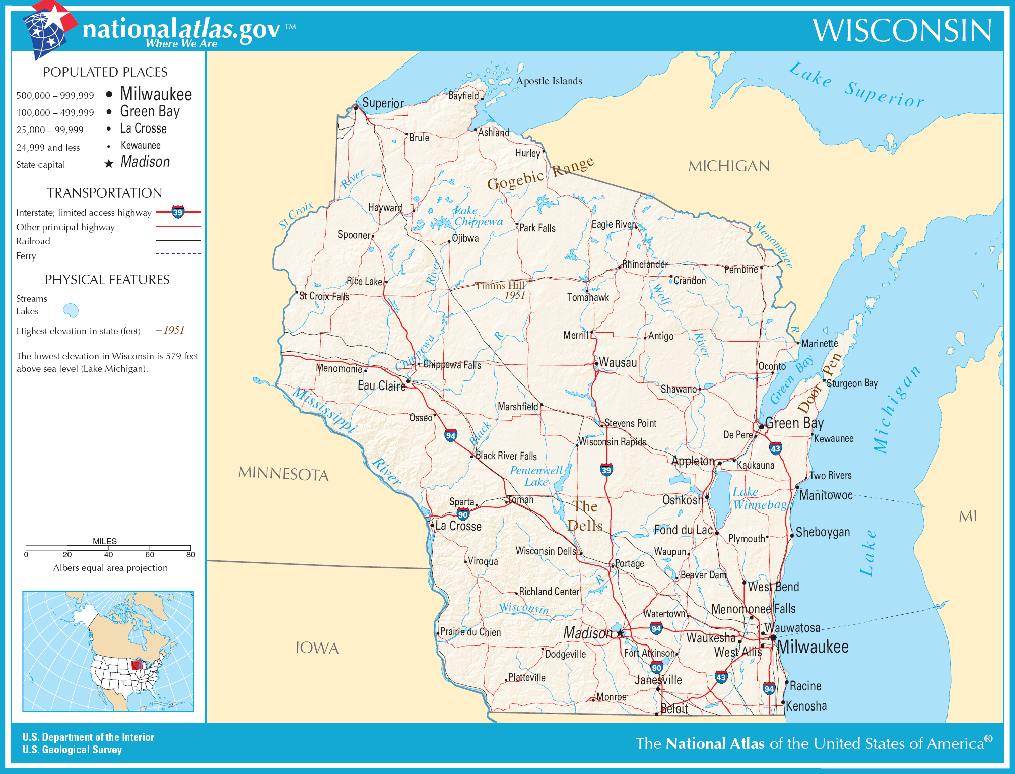
English: Map of Wisconsin. |
| Data | |
| Origine | National Atlas |
| Autor |
Licentia
This map was obtained from an edition of the National Atlas of the United States. Like almost all works of the U.S. federal government, works from the National Atlas are in the public domain in the United States.
Online access: NationalAtlas.gov | 1970 print edition: Library of Congress, Perry-Castañeda Library
|
Historia del file
Clicca sur un data/hora pro vider le file como appareva a ille tempore.
| Data/Hora | Miniatura | Dimensiones | Usator | Commento | |
|---|---|---|---|---|---|
| actual | 02:44, 16 octobre 2009 | | 2 015 × 1 536 (1,69 MB) | ZooFari | Trimmed |
| 09:09, 15 augusto 2006 |  | 2 122 × 1 640 (1,79 MB) | Huebi~commonswiki | {{Information| |Description=Map of Wisconsin |Source=[http://www.nationalatlas.gov National Atlas] }} Category:Maps of the United States Category:Maps of Wisconsin {{PD-USGov-Atlas}} |
Uso de iste file
Il non ha paginas que usa iste file.
Uso global de iste file
Le altere wikis sequente usa iste imagine:
- Uso in ca.wikipedia.org
- Uso in de.wikipedia.org
- Uso in en.wikipedia.org
- Uso in es.wikipedia.org
- Uso in fr.wikipedia.org
- Uso in hsb.wikipedia.org
- Uso in hu.wikipedia.org
- Uso in ilo.wikipedia.org
- Uso in it.wikipedia.org
- Uso in kn.wikipedia.org
- Uso in lt.wikipedia.org
- Uso in nl.wikipedia.org
- Uso in nl.wiktionary.org
- Uso in simple.wikipedia.org
- Uso in si.wikipedia.org
- Uso in sw.wikipedia.org
- Uso in szl.wikipedia.org
- Uso in uz.wikipedia.org
- Uso in zea.wikipedia.org