
File:Map of USA with county outlines (black & white).png

Dimension de iste previsualisation: 800 × 520 pixels.Altere resolutiones: 320 × 208 pixels | 640 × 416 pixels | 1 024 × 665 pixels | 1 513 × 983 pixels.
File original (1 513 × 983 pixels, dimension del file: 56 KB, typo MIME: image/png)
.png)

|
File:Usa counties large.svg is a vector version of this file. It should be used in place of this PNG file when not inferior.
File:Map of USA with county outlines (black & white).png → File:Usa counties large.svg
For more information, see Help:SVG. |
 |
Summario
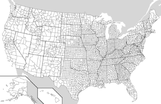
| Description | Map of the USA showing borders of states and counties. Adapted by Wapcaplet from a public-domain map courtesy of the U.S. Census Bureau website. |
| Data | |
| Origine | en:File:Map of USA with county outlines.png |
| Autor | |
| Altere versiones |
Derivative works of this file: File:Map of USA with county outlines.png |
Licentia
| Iste file es disponibile sub le licentia Creative Commons Attribution-CompartiSimile 3.0 Non-localisate. Subject to disclaimers. | ||
| ||
| Iste etiquetta de licentia esseva addite a iste file como parte del actualisation del licentia GFDL. |

|
Le permission es concedite de copiar, distribuer e/o modificar iste documento sub le conditiones del Licentia GNU pro Documentation Libere, Version 1.2 o omne version plus recente publicate per le Fundation pro Software Libere; sin Sectiones Invariabile, sin Textos de Copertura Frontal e sin Textos de Copertura Posterior. Un copia del licentia es includite in le section titulate Licentia GNU pro Documentation Libere. Subject to disclaimers. |
Historia del file
Clicca sur un data/hora pro vider le file como appareva a ille tempore.
| Data/Hora | Miniatura | Dimensiones | Usator | Commento | |
|---|---|---|---|---|---|
| actual | 09:34, 25 septembre 2006 | | 1 513 × 983 (56 KB) | Poulpy | {{Information |Description=Map of the USA showing borders of states and counties. Adapted by Wapcaplet from a public-domain map courtesy of the [http://www.census.gov/ U.S. Census Bureau website]. |Source=[[:en:Image:Map of USA w |
Uso de iste file
Il non ha paginas que usa iste file.
Uso global de iste file
Le altere wikis sequente usa iste imagine:
- Uso in en.wikipedia.org
- Uso in mwl.wikipedia.org
- Uso in pt.wikipedia.org
- Uso in ro.wikipedia.org
.png)