
File:Location Ardennes.PNG
Non disponibile in resolution plus alte.
Location_Ardennes.PNG (506 × 439 pixels, dimension del file: 40 KB, typo MIME: image/png)
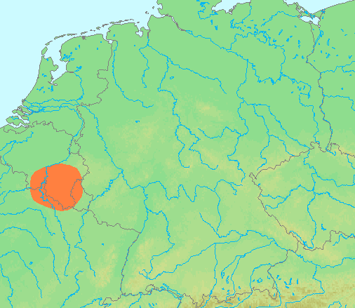
| Description | Locator maps for mountain ranges : Location Ardennes.PNG |
| Origine | demis maps, see below |
| Autor | 13:44, 29 June 2007 (UTC) |
This image is in the public domain because it came from the site https://www.demis.nl/products/web-map-server/examples/ and was released by the copyright holder. Permission is granted to copy, distribute and/or modify this map since it is based on free of copyright images from: www.demis.nl. See also approval email on de.wp and its clarification.
|
| This work has been released into the public domain by its copyright holder, www.demis.nl. This applies worldwide. In alcun paises isto pote non esser legalmente possibile. In tal caso: www.demis.nl concede a omnes le derecto de usar iste obra pro non importa qual fin, sin conditiones, a minus que tal conditiones sia requirite per lege.
|
Historia del file
Clicca sur un data/hora pro vider le file como appareva a ille tempore.
| Data/Hora | Miniatura | Dimensiones | Usator | Commento | |
|---|---|---|---|---|---|
| actual | 13:42, 29 junio 2007 | | 506 × 439 (40 KB) | Michiel1972 | {{Information |Description=Locator maps for mountain ranges : {{subst:PAGENAME}} |Source=demis maps, see below |Date= |Author={{Statistics Netherlands map}} |Permission=see below |other_versions= }} {{PD-Demis}} [[Category:Maps of mountain_ranges_of_Eu |
Uso de iste file
Le sequente pagina usa iste file:
Uso global de iste file
Le altere wikis sequente usa iste imagine:
- Uso in af.wikipedia.org
- Uso in ar.wikipedia.org
- Uso in arz.wikipedia.org
- Uso in be-tarask.wikipedia.org
- Uso in ca.wikipedia.org
- Uso in ceb.wikipedia.org
- Uso in cs.wikipedia.org
- Uso in de.wikipedia.org
- Uso in de.wiktionary.org
- Uso in en.wikipedia.org
- Uso in eo.wikipedia.org
- Uso in es.wikipedia.org
- Uso in eu.wikipedia.org
- Uso in fy.wikipedia.org
- Uso in hy.wikipedia.org
- Uso in incubator.wikimedia.org
- Uso in is.wikipedia.org
- Uso in ja.wikipedia.org
- Uso in ko.wikipedia.org
- Uso in li.wikipedia.org
- Uso in lt.wikipedia.org
- Uso in ms.wikipedia.org
- Uso in pcd.wikipedia.org
- Uso in pl.wikipedia.org
- Uso in pl.wiktionary.org
- Uso in pnb.wikipedia.org
- Uso in simple.wikipedia.org
- Uso in sk.wikipedia.org
- Uso in sv.wikipedia.org
- Uso in th.wikipedia.org
- Uso in uk.wikipedia.org
- Uso in wa.wikipedia.org
- Uso in www.wikidata.org
- Uso in zh-yue.wikipedia.org
- Uso in zh.wikipedia.org