
File:Ecuador (orthographic projection).svg

Dimension de iste previsualisation PNG de iste file SVG: 512 × 512 pixels. Altere resolutiones: 240 × 240 pixels | 480 × 480 pixels | 768 × 768 pixels | 1 024 × 1 024 pixels | 2 048 × 2 048 pixels.
File original (File SVG, dimensiones nominal: 512 × 512 pixels, grandor del file: 66 KB)
Summario
| Description |
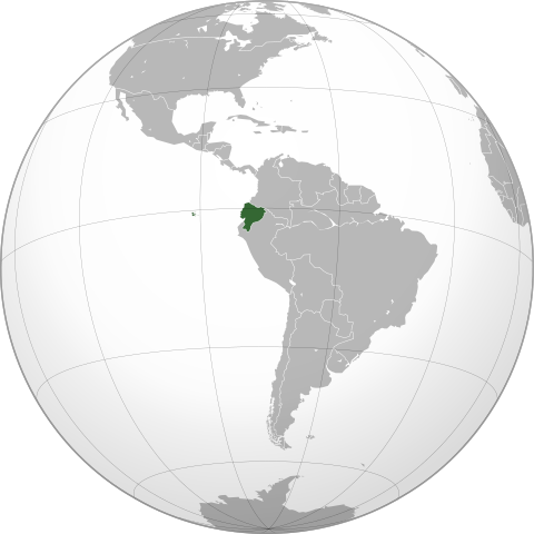
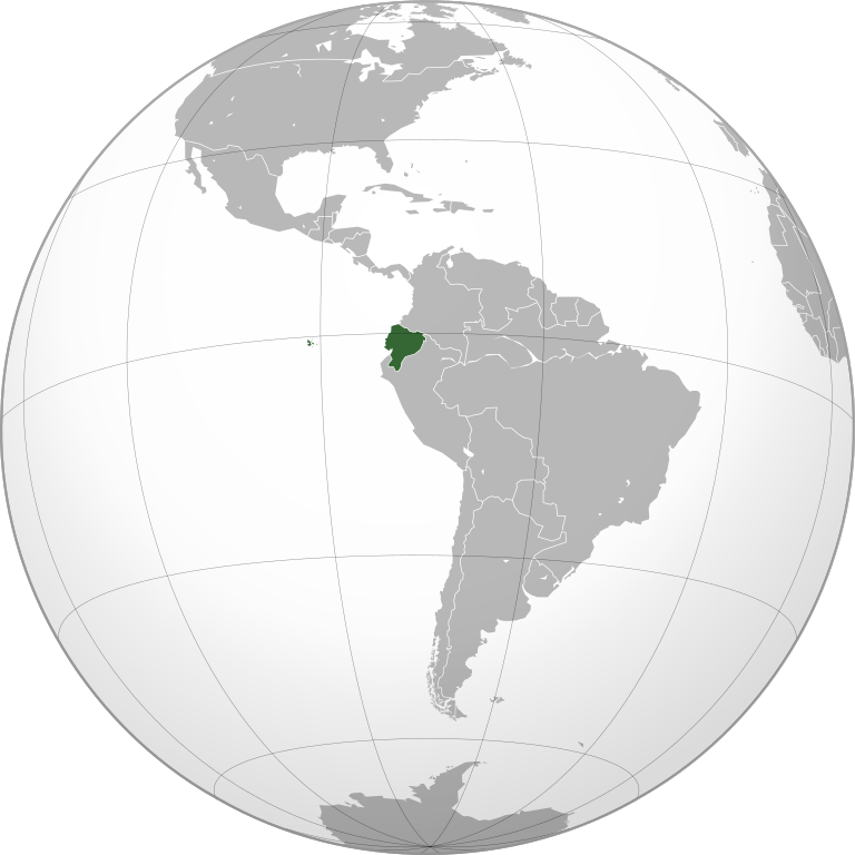
English: Map of Ecuador |
||||
| SVG genesis | |||||
| Data | |||||
| Origine |
Obra proprie,
|
||||
| Autor | Addicted04 | ||||
| Altere versiones |
.svg)
|
.svg)
.svg)
.svg)
.svg)
.svg)
.svg)
.svg)
.svg)
.svg)
.svg)
.svg)
.svg)
.svg)
.svg)
.svg)
.svg)
.svg)
.svg)
.svg)
.svg)
.svg)
.svg)
.svg)
.svg)
.svg)
.svg)
.svg)
.svg)
.svg)
.svg)
.svg)
.svg)
.svg)
.svg)
.svg)
.svg)
.svg)
.svg)
.svg)
.svg)
.svg)
.svg)
.svg)
.svg)
.svg)
.svg)
.svg)
.svg)
.svg)
.svg)
.svg)
.svg)
.svg)
.svg)
.svg)
.svg)
.svg)
.svg)
.svg)
.svg)
.svg)
.svg)
.svg)
.svg)
.svg)
.svg)
.svg)
.svg)
.svg)
.svg)
.svg)
.svg)
.svg)

.svg)

.svg)

.svg)
.svg)
.svg)
.svg)
.svg)
.svg)
.svg)


.svg)
.svg)
.svg)
.svg)
.svg)
.svg)
.svg)

.svg)
.svg)
.svg)
.svg)
.svg)
.svg)
.svg)
.svg)
.svg)
.svg)

.svg)
.svg)
.svg)
.svg)
.svg)
.svg)
.svg)
_without_national_boundaries.svg)
.svg)
.svg)
.svg)
.svg)
.svg)
.svg)

.svg)
.svg)
.png)
.svg)
.svg)
.svg)
.svg)

.svg)
.svg)
.svg)
.svg)
.svg)
.svg)
.svg)
.svg)
.svg)
.svg)
.svg)

.svg)
.svg)
.svg)
.svg)
.svg)
.svg)
.svg)
.svg)
.svg)

.svg)
.svg)

.svg)
.svg)
.svg)
.svg)
.svg)
.svg)
.svg)
.svg)
.svg)
.svg)
.svg)
.svg)
.svg)
.svg)
.svg)
.svg)
.svg)
.svg)
.svg)
.svg)
.svg)
.svg)
.svg)
.svg)
.svg)
.svg)
.svg)
_-_Crimea_disputed.svg)
.svg)
.svg)
.svg)
.svg)
.svg)
.svg)
.svg)
.svg)
.svg)
.svg)
.svg)
_political.svg)
.svg)
.svg)
.svg)
.svg)
_-_Crimea_disputed_-_no_borders.svg)
.svg)
.svg)
.svg)
.svg)
.svg)
.svg)
.svg)
.svg)
.svg)
.svg)
.svg)

.svg)
.svg)
.svg)

.png)
.svg)
.svg)
.svg)
.svg)
.svg)
.svg)
.svg)
.svg)
.svg)
.svg)
.svg)
.svg)
.svg)
.svg)
.svg)
.svg)
.svg)
.svg)
.svg)
.svg)
.svg)
.svg)
.svg)
.svg)
.svg)
.svg)
.svg)
.svg)
.svg)
.svg)
.svg)
.svg)
.svg)
.svg)
.png)
.svg)
.svg)
.svg)
_(orthographic_projection).png)
.svg)
.svg)
.svg)
Licentia
Io, titular del derecto de autor sur iste obra, declara de publicar lo sub le sequente licentias:
Iste file es disponibile sub le licentia Creative Commons Attribution-CompartiSimile 3.0 Non-localisate.
- Tu es libere:
- de condivider – de copiar, distribuer e transmitter le obra
- de remixar – de adaptar le obra
- Sub le sequente conditiones:
- attribution – Tu debe dar information appropriate sur le autor, fornir un ligamine al licentia, e indicar si modificationes ha essite apportate. Tu pote facer lo de qualcunque maniera rationabile, ma non in alcun modo que suggere que le licentiator approba te o tu uso del obra.
- condivider equalmente – Si tu altera, transforma o disveloppa le material, tu debe distribuer tu contributiones sub un licentia identic o compatibile con le original.

|
Le permission es concedite de copiar, distribuer e/o modificar iste documento sub le conditiones del Licentia GNU pro Documentation Libere, Version 1.2 o omne version plus recente publicate per le Fundation pro Software Libere; sin Sectiones Invariabile, sin Textos de Copertura Frontal e sin Textos de Copertura Posterior. Un copia del licentia es includite in le section titulate Licentia GNU pro Documentation Libere. |
Tu pote seliger le licentia de tu preferentia.
| Annotations | This image is annotated: View the annotations at Commons |
Historia del file
Clicca sur un data/hora pro vider le file como appareva a ille tempore.
| Data/Hora | Miniatura | Dimensiones | Usator | Commento | |
|---|---|---|---|---|---|
| actual | 19:05, 29 octobre 2017 | | 512 × 512 (66 KB) | JoKalliauer | made file valid |
| 18:29, 20 novembre 2009 |  | 549 × 549 (767 KB) | Addicted04 | Centered version | |
| 01:25, 1 junio 2009 |  | 541 × 541 (311 KB) | Connormah | Fix? | |
| 00:06, 1 junio 2009 |  | 541 × 541 (311 KB) | Connormah | TJ | |
| 23:22, 31 maio 2009 |  | 541 × 541 (310 KB) | Connormah | {{Information |Description={{en|1=Orthographic projection of Ecuador.}} |Source=Own work by uploader |Author=Connormah |Date= |Permission= |other_versions= }} <!--{{ImageUpload|full}}--> |
Uso de iste file
Il non ha paginas que usa iste file.
Uso global de iste file
Le altere wikis sequente usa iste imagine:
- Uso in ady.wikipedia.org
- Uso in af.wikipedia.org
- Uso in ami.wikipedia.org
- Uso in ang.wikipedia.org
- Uso in awa.wikipedia.org
- Uso in azb.wikipedia.org
- Uso in az.wikipedia.org
- Uso in az.wiktionary.org
- Uso in bcl.wikipedia.org
- Uso in be.wikipedia.org
- Uso in bi.wikipedia.org
- Uso in bn.wikipedia.org
- Uso in bxr.wikipedia.org
- Uso in cdo.wikipedia.org
- Uso in ceb.wikipedia.org
- Uso in chr.wikipedia.org
- Uso in ckb.wikipedia.org
- Uso in cs.wikipedia.org
- Uso in da.wikipedia.org
- Uso in da.wiktionary.org
- Uso in dv.wikipedia.org
- Uso in el.wikipedia.org
- Uso in en.wikipedia.org
- Uso in en.wikinews.org
- Category:Ecuador
- Template:Ecuador
- Pyrotechnics at Ecuador nightclub rock concert trigger 15-fatality fire
- Protests in Ecuador kill one, injure 49
- British scientist shot dead in Ecuador was ‘unlawfully killed’
- Former Ecuadorian football referee Byron Moreno arrested for drug smuggling
- Four miners trapped in Ecuador mine
- Template:Infobox/lookup/Ecuador
- Uso in en.wiktionary.org
- Uso in eo.wikipedia.org
- Uso in es.wikipedia.org
- Uso in fa.wikipedia.org
- Uso in fiu-vro.wikipedia.org
- Uso in fo.wikipedia.org
- Uso in frr.wikipedia.org
- Uso in gag.wikipedia.org
- Uso in gu.wikipedia.org
- Uso in hak.wikipedia.org
- Uso in hi.wikipedia.org
- Uso in hy.wikipedia.org
Vider altere usos global de iste file.
.svg)
.svg)