
File:Balkan-range-satellite.jpg

Dimension de iste previsualisation: 800 × 562 pixels.Altere resolutiones: 320 × 225 pixels | 640 × 450 pixels | 1 024 × 719 pixels | 1 280 × 899 pixels | 2 379 × 1 671 pixels.
File original (2 379 × 1 671 pixels, dimension del file: 691 KB, typo MIME: image/jpeg)
Summario
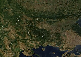
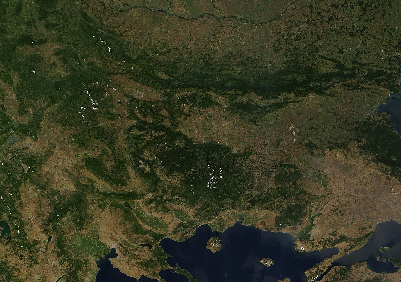
| Description | Satellite image of the Balkan mountains (Stara Planina). The mountain range is running across the territory of Bulgaria. |
| Origine | NASA, Image:Satellite image of Greece.jpg |
| Autor | User:Introvert |
| Permission (Reuso de iste file) |
Original image from NASA, cropped Image:Satellite image of Greece.jpg |
Licentia
| This file is in the public domain in the United States because it was solely created by NASA. NASA copyright policy states that "NASA material is not protected by copyright unless noted". (See Template:PD-USGov, NASA copyright policy page or JPL Image Use Policy.) | ||
 |
Warnings:
|
Historia del file
Clicca sur un data/hora pro vider le file como appareva a ille tempore.
| Data/Hora | Miniatura | Dimensiones | Usator | Commento | |
|---|---|---|---|---|---|
| actual | 23:38, 21 decembre 2005 | | 2 379 × 1 671 (691 KB) | Introvert | {{Information| |Description=Satellite image of the Balkan mountains (Stara Planina). The moutain range is running across the territory of Bulgaria. |Source=NASA |Date= |Author=User:Introvert |Permission=Original image from NASA, cropped |other |
Uso de iste file
Le sequente pagina usa iste file:
Uso global de iste file
Le altere wikis sequente usa iste imagine:
- Uso in arz.wikipedia.org
- Uso in ast.wikipedia.org
- Uso in az.wikipedia.org
- Uso in ba.wikipedia.org
- Uso in be.wikipedia.org
- Uso in br.wikipedia.org
- Uso in ca.wikipedia.org
- Uso in ceb.wikipedia.org
- Uso in ckb.wikipedia.org
- Uso in da.wikipedia.org
- Uso in eo.wikipedia.org
- Uso in eo.wikiquote.org
- Uso in eu.wikipedia.org
- Uso in fr.wikinews.org
- Uso in fr.wikivoyage.org
- Uso in ga.wikipedia.org
- Uso in kab.wikipedia.org
- Uso in kcg.wikipedia.org
- Uso in ku.wikipedia.org
- Uso in sv.wikipedia.org
- Uso in tg.wikipedia.org
- Uso in tt.wikipedia.org
- Uso in vec.wikipedia.org
- Uso in www.wikidata.org