
File:(La Línea de la Concepción) Гибралтар. Начало Испании - от Атлантического океана до Средиземного моря. - panoramio (cropped).jpg

Dimension de iste previsualisation: 800 × 434 pixels.Altere resolutiones: 320 × 173 pixels | 640 × 347 pixels | 1 024 × 555 pixels | 1 280 × 694 pixels | 3 772 × 2 045 pixels.
File original (3 772 × 2 045 pixels, dimension del file: 3,03 MB, typo MIME: image/jpeg)
Summario
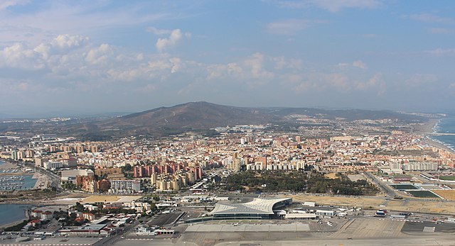
| Description | Гибралтар. Начало Испании - от Атлантического океана до Средиземного моря. |
| Data | Taken on 28 de septembre 2014 |
| Origine | https://www.panoramio.com/photo/113718271 |
| Autor | tiger rus |
| Permission (Reuso de iste file) |
Iste file es disponibile sub le licentia Creative Commons Attribution 3.0 Unported. Attribution: tiger rus
|
| Altere versiones | |
| Panoramio Tags | Gibraltar, British overseas territories, Gibraltar, Британские заморские территории, Гибралтар |

_%D0%93%D0%B8%D0%B1%D1%80%D0%B0%D0%BB%D1%82%D0%B0%D1%80._%D0%9D%D0%B0%D1%87%D0%B0%D0%BB%D0%BE_%D0%98%D1%81%D0%BF%D0%B0%D0%BD%D0%B8%D0%B8_-_%D0%BE%D1%82_%D0%90%D1%82%D0%BB%D0%B0%D0%BD%D1%82%D0%B8%D1%87%D0%B5%D1%81%D0%BA%D0%BE%D0%B3%D0%BE_%D0%BE%D0%BA%D0%B5%D0%B0%D0%BD%D0%B0_%D0%B4%D0%BE_%D0%A1%D1%80%D0%B5%D0%B4%D0%B8%D0%B7%D0%B5%D0%BC%D0%BD%D0%BE%D0%B3%D0%BE_%D0%BC%D0%BE%D1%80%D1%8F._-_panoramio_(cropped).jpg)
| Camera location | | View this and other nearby images on: OpenStreetMap |
|---|
_%D0%93%D0%B8%D0%B1%D1%80%D0%B0%D0%BB%D1%82%D0%B0%D1%80._%D0%9D%D0%B0%D1%87%D0%B0%D0%BB%D0%BE_%D0%98%D1%81%D0%BF%D0%B0%D0%BD%D0%B8%D0%B8_-_%D0%BE%D1%82_%D0%90%D1%82%D0%BB%D0%B0%D0%BD%D1%82%D0%B8%D1%87%D0%B5%D1%81%D0%BA%D0%BE%D0%B3%D0%BE_%D0%BE%D0%BA%D0%B5%D0%B0%D0%BD%D0%B0_%D0%B4%D0%BE_%D0%A1%D1%80%D0%B5%D0%B4%D0%B8%D0%B7%D0%B5%D0%BC%D0%BD%D0%BE%D0%B3%D0%BE_%D0%BC%D0%BE%D1%80%D1%8F._-_panoramio_(cropped).jpg¶ms=036.145318_N_-005.345239_E_globe:Earth_type:camera_source:Panoramio_&language=ia)
| Annotations | This image is annotated: View the annotations at Commons |
Historia del file
Clicca sur un data/hora pro vider le file como appareva a ille tempore.
| Data/Hora | Miniatura | Dimensiones | Usator | Commento | |
|---|---|---|---|---|---|
| actual | 03:22, 11 martio 2019 | | 3 772 × 2 045 (3,03 MB) | Up and Go | File:Гибралтар. Начало Испании - от Атлантического океана до Средиземного моря. - panoramio.jpg cropped 27 % horizontally, 41 % vertically using CropTool with lossless mode. |
Uso de iste file
Le sequente pagina usa iste file:
Uso global de iste file
Le altere wikis sequente usa iste imagine:
- Uso in an.wikipedia.org
- Uso in ar.wikipedia.org
- Uso in arz.wikipedia.org
- Uso in be.wikipedia.org
- Uso in br.wikipedia.org
- Uso in ca.wikipedia.org
- Uso in ceb.wikipedia.org
- Uso in ce.wikipedia.org
- Uso in da.wikipedia.org
- Uso in de.wikipedia.org
- Uso in de.wikivoyage.org
- Uso in en.wikipedia.org
- Uso in es.wikipedia.org
- Uso in et.wikipedia.org
- Uso in eu.wikipedia.org
- Uso in gl.wikipedia.org
- Uso in hu.wikipedia.org
- Uso in hy.wikipedia.org
- Uso in ka.wikipedia.org
- Uso in lld.wikipedia.org
- Uso in lmo.wikipedia.org
- Uso in lt.wikipedia.org
- Uso in mt.wikipedia.org
- Uso in os.wikipedia.org
- Uso in pl.wikipedia.org
- Uso in pl.wikivoyage.org
- Uso in ro.wikipedia.org
- Uso in ru.wikipedia.org
- Uso in sr.wikipedia.org
- Uso in sv.wikipedia.org
- Uso in tt.wikipedia.org
- Uso in uz.wikipedia.org
- Uso in vec.wikipedia.org
- Uso in vi.wikipedia.org
- Uso in www.wikidata.org
_Гибралтар._Начало_Испании_-_от_Атлантического_океана_до_Средиземного_моря._-_panoramio_(cropped).jpg)