
File:Seven United Netherlands Janssonius 1658.jpg
Dimension de iste previsualisation: 695 × 600 pixels.Altere resolutiones: 278 × 240 pixels | 556 × 480 pixels | 890 × 768 pixels | 1 187 × 1 024 pixels | 2 374 × 2 048 pixels | 5 543 × 4 782 pixels.
File original (5 543 × 4 782 pixels, dimension del file: 14,63 MB, typo MIME: image/jpeg)
| Description |
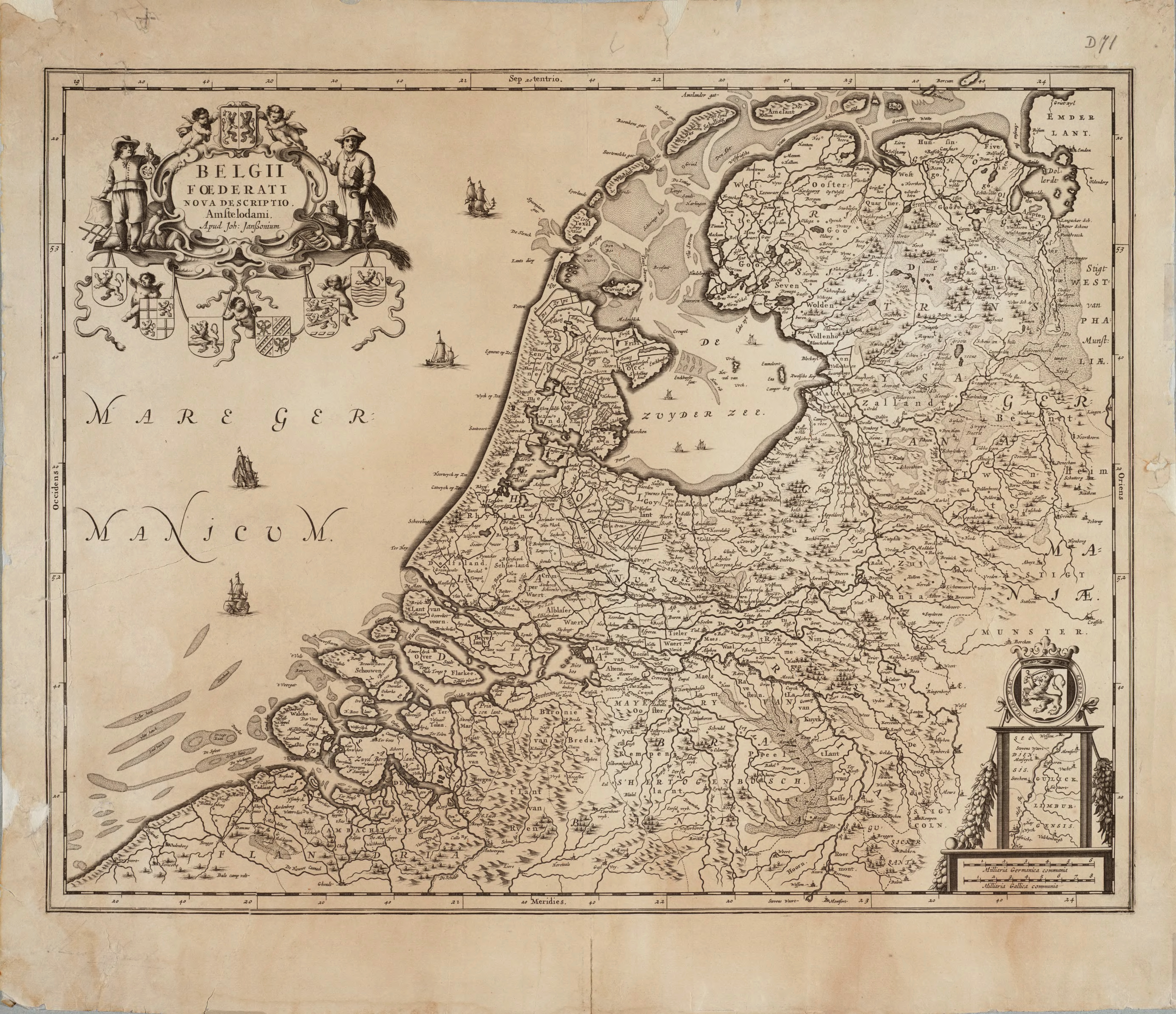
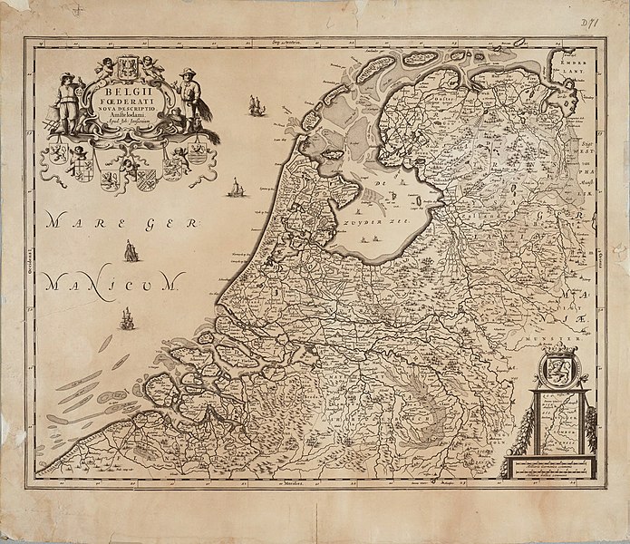
English: Map of the Republic of the Seven United Netherlands Drawn by Joannes (or Johannes) Janssonius, part of his collection Belgii Foederati Nova Descriptio |
|||||||||||||||||||||||||
| Data | ||||||||||||||||||||||||||
| Origine | Archieven.nl Oude versie kwam van:Universiteit van Groningen | |||||||||||||||||||||||||
| Autor |
|
|||||||||||||||||||||||||
| Permission (Reuso de iste file) |
|
|||||||||||||||||||||||||
Historia del file
Clicca sur un data/hora pro vider le file como appareva a ille tempore.
| Data/Hora | Miniatura | Dimensiones | Usator | Commento | |
|---|---|---|---|---|---|
| actual | 11:52, 16 decembre 2010 | | 5 543 × 4 782 (14,63 MB) | Joopr | De hele kaart met onderste rand, tevens hogere resolutie. |
| 21:01, 24 april 2010 |  | 3 343 × 2 535 (3,92 MB) | Cropbot | upload cropped version, operated by User:DieBuche. Summary: cropped | |
| 11:46, 30 julio 2005 |  | 3 426 × 2 550 (1,22 MB) | BenTels | Map of the Republic of the Seven United Netherlands<br> Drawn by Joannes (or ''Johannes'') Janssonius<br> Part of his atlas ''Belgii Foederati Nova Descriptio''<br> Published in Amsterdam in 1658 Map predates international copyright law, plus author |
Uso de iste file
Le sequente pagina usa iste file:
Uso global de iste file
Le altere wikis sequente usa iste imagine:
- Uso in ar.wikipedia.org
- Uso in bg.wikipedia.org
- Uso in br.wikipedia.org
- Uso in ca.wikipedia.org
- Uso in cs.wikipedia.org
- Uso in cy.wikipedia.org
- Uso in da.wikipedia.org
- Uso in de.wikipedia.org
- Uso in de.wikivoyage.org
- Uso in el.wikipedia.org
- Uso in en.wikipedia.org
- Uso in eo.wikipedia.org
- Uso in es.wikipedia.org
- Uso in et.wikipedia.org
- Uso in eu.wikipedia.org
- Uso in fa.wikipedia.org
- Uso in frr.wikipedia.org
- Uso in fr.wikipedia.org
- Uso in fy.wikipedia.org
Vider altere usos global de iste file.