
File:Rs map02.png
Dimension de iste previsualisation: 561 × 599 pixels.Altere resolutiones: 225 × 240 pixels | 449 × 480 pixels | 977 × 1 044 pixels.
File original (977 × 1 044 pixels, dimension del file: 51 KB, typo MIME: image/png)
Summario
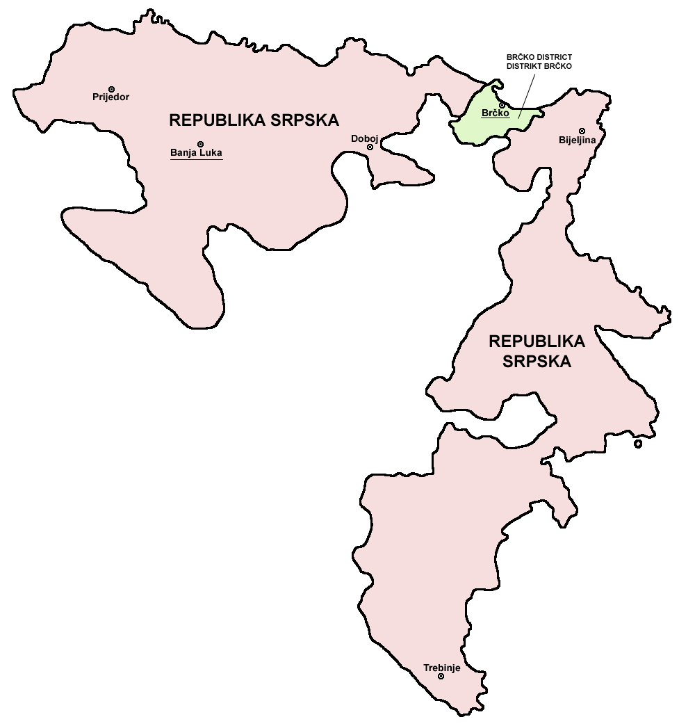
- English: Map of the Republika Srpska (Serb Republic) and Brčko District.
- Serbian: Mapa Republike Srpske i Distrikta Brčko.
Source and licence

|
This map has been uploaded by Electionworld from en.wikipedia.org to enable the |
self made map by user:PANONIAN
| Io, titular del derecto de autor sur iste obra, libera iste obra al dominio public. Isto vale in tote le mundo. In alcun paises isto pote non esser legalmente possibile. In tal caso: Io concede a omnes le derecto de usar iste obra pro non importa qual fin, sin conditiones, a minus que tal conditiones sia requirite per lege. |
References
- Slobodan Radovanović, Geografski atlas, Magic Map, Smederevska Palanka, 2001.
- Geografski atlas, Intersistem kartografija, Beograd, 2004.
- http://www.ohr.int/ohr-offices/brcko/images/map-brcko-district.jpg
- http://world-gazetteer.com/ archive copy at the Wayback Machine
Historia del file
Clicca sur un data/hora pro vider le file como appareva a ille tempore.
| Data/Hora | Miniatura | Dimensiones | Usator | Commento | |
|---|---|---|---|---|---|
| actual | 08:56, 5 augusto 2011 | | 977 × 1 044 (51 KB) | PANONIAN | improved version |
| 08:41, 5 augusto 2011 |  | 610 × 602 (11 KB) | PANONIAN | Reverted to version as of 10:03, 16 July 2007 - please do not upload your work over mine. upload your map under separate filename | |
| 00:24, 11 april 2011 |  | 610 × 655 (92 KB) | Kacnepcku-Cp6uja | better quality | |
| 10:03, 16 julio 2007 |  | 610 × 602 (11 KB) | Nihad Hamzic | The original image seems to had been saved as JPEG, and the previous uploader had simply directly converted it to PNG. I have greatly optimised image size by removing JPEG artifacts, reducing color domain etc. | |
| 15:48, 28 decembre 2006 |  | 610 × 602 (143 KB) | Electionworld | {{ew|en|PANONIAN}} {{link|Republika Srpska}} map (self made) {{PD-self}} Note: The borders of Republika Srpska were not determined on the basis of the natural geographical features of the region. Rather, the Inter-Entity Boundary Line runs essentially al |
Uso de iste file
Il non ha paginas que usa iste file.
Uso global de iste file
Le altere wikis sequente usa iste imagine:
- Uso in ast.wikipedia.org
- Uso in gl.wikipedia.org
- Uso in ie.wikipedia.org
- Uso in ja.wikipedia.org
- Uso in ka.wikipedia.org
- Uso in la.wikipedia.org
- Uso in lv.wikipedia.org
- Uso in oc.wikipedia.org
- Uso in ro.wikipedia.org
- Uso in szl.wikipedia.org
- Uso in ur.wikipedia.org
- Uso in xmf.wikipedia.org