
File:Map of Hispaniola.JPG
Dimension de iste previsualisation: 780 × 600 pixels.Altere resolutiones: 312 × 240 pixels | 625 × 480 pixels | 999 × 768 pixels | 1 280 × 984 pixels | 2 286 × 1 757 pixels.
File original (2 286 × 1 757 pixels, dimension del file: 771 KB, typo MIME: image/jpeg)
Summario
| Description |
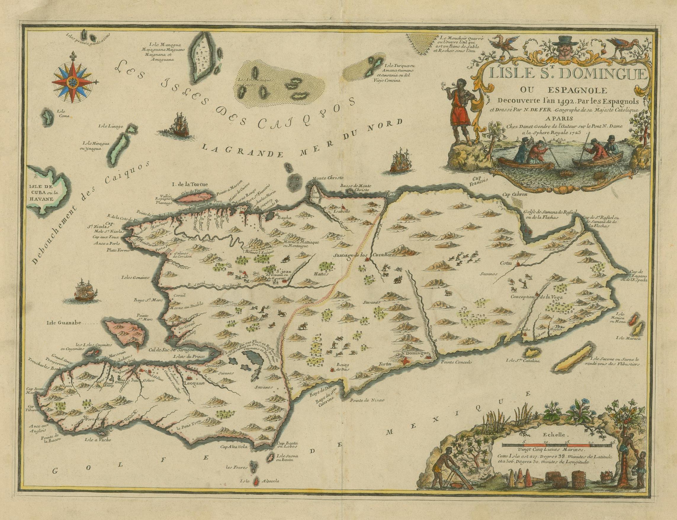
English: The island of Santo Domingo or Hispaniola, discovered in 1492. Français : L'Isle St. Domingue ou Espagnole Decouverte l'an 1492. Par les Espagnols |
||||||||||||||||||||
| Data | |||||||||||||||||||||
| Origine |
https://jcb.lunaimaging.com/luna/servlet/s/3l9bzf JCB Map Cabinet Em 723 FeN library catalog record |
||||||||||||||||||||
| Autor |
|
||||||||||||||||||||


Licentia
|
This work is in the public domain in its country of origin and other countries and areas where the copyright term is the author's life plus 100 years or fewer. This work is in the public domain in the United States because it was published (or registered with the U.S. Copyright Office) before January 1, 1929. | |
| Iste file ha essite identificate como essente libere de restrictiones cognoscite sub lege de copyright, incluse tote le derectos connexe e vicin. | |
Historia del file
Clicca sur un data/hora pro vider le file como appareva a ille tempore.
| Data/Hora | Miniatura | Dimensiones | Usator | Commento | |
|---|---|---|---|---|---|
| actual | 17:32, 7 septembre 2018 | | 2 286 × 1 757 (771 KB) | Fernandezmv | High resolution, full color image |
| 07:10, 30 junio 2005 |  | 2 556 × 1 960 (1,01 MB) | Schlacke-Heiner | Spanish Map of Hispaniola by 1723, Original in The John Carter Brown Library, Brown University {{PD}} Category:18th century maps |
Uso de iste file
Le sequente pagina usa iste file:
Uso global de iste file
Le altere wikis sequente usa iste imagine:
- Uso in ast.wikipedia.org
- Uso in br.wikipedia.org
- Uso in ca.wikipedia.org
- Uso in de.wikipedia.org
- Uso in el.wikipedia.org
- Uso in en.wikipedia.org
- Uso in eo.wikipedia.org
- Uso in es.wikipedia.org
- Uso in fr.wikipedia.org
- Uso in gl.wikipedia.org
- Uso in hsb.wikipedia.org
- Uso in is.wikipedia.org
- Uso in la.wikipedia.org
- Uso in no.wikipedia.org
- Uso in pt.wikipedia.org
- Uso in ro.wikipedia.org
- Uso in ta.wikipedia.org