
File:LocationIndia.png

Dimension de iste previsualisation: 800 × 370 pixels.Altere resolutiones: 320 × 148 pixels | 640 × 296 pixels | 1 357 × 628 pixels.
File original (1 357 × 628 pixels, dimension del file: 21 KB, typo MIME: image/png)

|
This locator map image could be re-created using vector graphics as an SVG file. This has several advantages; see Commons:Media for cleanup for more information. If an SVG form of this image is available, please upload it and afterwards replace this template with
{{vector version available|new image name}}.
It is recommended to name the SVG file “LocationIndia.svg”—then the template Vector version available (or Vva) does not need the new image name parameter. |
Summario
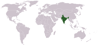
Location map for w:India.
User:dbenbenn modified Image:BlankMap-World.png.
Licentia
| |
Iste obra ha essite liberate al dominio public per su autor, Vardion, at the anglese Wikipedia project. Isto vale in tote le mundo. In case this is not legally possible: |
Historia del file
Clicca sur un data/hora pro vider le file como appareva a ille tempore.
| Data/Hora | Miniatura | Dimensiones | Usator | Commento | |
|---|---|---|---|---|---|
| actual | 07:35, 11 septembre 2021 | | 1 357 × 628 (21 KB) | Ytpks896 | Reverted to version as of 22:39, 12 February 2005 (UTC) |
| 13:37, 29 julio 2021 |  | 1 427 × 628 (103 KB) | Ytpks896 | Reverted to version as of 03:16, 1 May 2008 (UTC) | |
| 00:33, 15 februario 2010 |  | 1 357 × 628 (24 KB) | King Zebu | Reverted to version as of 09:17, 3 June 2005 Please discuss before making such edits in future. | |
| 03:16, 1 maio 2008 |  | 1 427 × 628 (103 KB) | KAVO | (Changed to colours more noticeable: *Light green - Claimed by India, not administered by India **(Aksai Chin, Azad Kashmir, Northern Areas, Shaksgam Valley) *Deep Green - Disputed with other nations, administered by India **(Arunachal Pradesh, Jammu and | |
| 09:17, 3 junio 2005 |  | 1 357 × 628 (24 KB) | Nichalp | NPOV map, please discuss any changes with me for NPOV status | |
| 22:39, 12 februario 2005 |  | 1 357 × 628 (21 KB) | Dbenbenn | higher resolution version, without black border | |
| 20:28, 5 decembre 2004 |  | 250 × 115 (18 KB) | EugeneZelenko | Location map for India.<br/>Originally created for English Wikipedia by Vardion.<br/>{{GFDL}} |
Uso de iste file
Il non ha paginas que usa iste file.
Uso global de iste file
Le altere wikis sequente usa iste imagine:
- Uso in ar.wikinews.org
- Uso in ckb.wikipedia.org
- Uso in en.wikipedia.org
- Uso in en.wikinews.org
- Uso in en.wikivoyage.org
- Uso in en.wiktionary.org
- Uso in es.wikipedia.org
- Uso in fr.wikinews.org
- Uso in fur.wikipedia.org
- Uso in he.wikivoyage.org
- Uso in hr.wikipedia.org
- Uso in hr.wikiquote.org
- Uso in incubator.wikimedia.org
- Uso in ko.wikipedia.org
- Uso in li.wikinews.org
- Uso in pam.wikipedia.org
- Uso in pl.wiktionary.org
- Uso in ps.wikivoyage.org
- Uso in pt.wikivoyage.org
Vider altere usos global de iste file.