
File:Georgia (orthographic projection).svg

Dimension de iste previsualisation PNG de iste file SVG: 553 × 553 pixels. Altere resolutiones: 240 × 240 pixels | 480 × 480 pixels | 768 × 768 pixels | 1 024 × 1 024 pixels | 2 048 × 2 048 pixels.
File original (File SVG, dimensiones nominal: 553 × 553 pixels, grandor del file: 302 KB)
Summario
| Description |
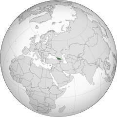
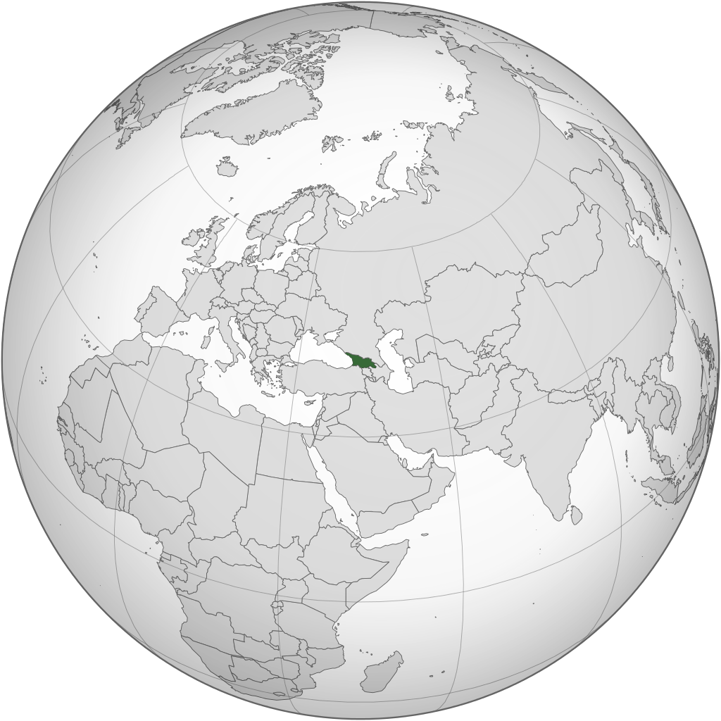
English: Location of Georgia.
.svg) |
| Data | |
| Origine | Obra proprie |
| Autor | Izzedine |
| Altere versiones |
.svg) .svg) |
| SVG genesis |
.svg)
.svg)
.svg)
.svg)
.svg)
.svg)
.svg)
.svg)
.svg)
.svg)
.svg)
.svg)
.svg)
.svg)
.svg)
.svg)
.svg)
.svg)
.svg)
.svg)
.svg)
.svg)
.svg)
.svg)
.svg)
.svg)
.svg)
.svg)
.svg)
.svg)
.svg)
.svg)
.svg)
.svg)
.svg)
.svg)
.svg)
.svg)
.svg)
.svg)
.svg)
.svg)
.svg)
.svg)
.svg)
.svg)
.svg)
.svg)
.svg)
.svg)
.svg)
.svg)
.svg)
.svg)
.svg)
.svg)
.svg)
.svg)
.svg)
.svg)
.svg)
.svg)
.svg)
.svg)
.svg)
.svg)
.svg)
.svg)
.svg)
.svg)
.svg)
.svg)
.svg)

.svg)

.svg)

.svg)
.svg)
.svg)
.svg)
.svg)
.svg)
.svg)


.svg)
.svg)
.svg)
.svg)
.svg)
.svg)
.svg)

.svg)
.svg)
.svg)
.svg)
.svg)
.svg)
.svg)
.svg)
.svg)
.svg)

.svg)
.svg)
.svg)
.svg)
.svg)
.svg)
.svg)
_without_national_boundaries.svg)
.svg)
.svg)
.svg)
.svg)
.svg)
.svg)

.svg)
.svg)
.png)
.svg)
.svg)

.svg)
.svg)
.svg)
.svg)
.svg)
.svg)
.svg)
.svg)
.svg)
.svg)
.svg)

.svg)
.svg)
.svg)
.svg)
.svg)
.svg)
.svg)
.svg)
.svg)

.svg)
.svg)

.svg)
.svg)
.svg)
.svg)
.svg)
.svg)
.svg)
.svg)
.svg)
.svg)
.svg)
.svg)
.svg)
.svg)
.svg)
.svg)
.svg)
.svg)
.svg)
.svg)
.svg)
.svg)
.svg)
.svg)
.svg)
.svg)
.svg)
_-_Crimea_disputed.svg)
.svg)
.svg)
.svg)
.svg)
.svg)
.svg)
.svg)
.svg)
.svg)
.svg)
.svg)
_political.svg)
.svg)
.svg)
.svg)
.svg)
_-_Crimea_disputed_-_no_borders.svg)
.svg)
.svg)
.svg)
.svg)
.svg)
.svg)
.svg)
.svg)
.svg)
.svg)
.svg)

.svg)
.svg)
.svg)

.png)
.svg)
.svg)
.svg)
.svg)
.svg)
.svg)
.svg)
.svg)
.svg)
.svg)
.svg)
.svg)
.svg)
.svg)
.svg)
.svg)
.svg)
.svg)
.svg)
.svg)
.svg)
.svg)
.svg)
.svg)
.svg)
.svg)
.svg)
.svg)
.svg)
.svg)
.svg)
.svg)
.svg)
.svg)
.png)
.svg)
.svg)
.svg)
_(orthographic_projection).png)
.svg)
Licentia
Io, titular del derecto de autor sur iste obra, declara de publicar lo sub le sequente licentia:
Iste file es disponibile sub le licentia Creative Commons Attribution-CompartiSimile 3.0 Non-localisate.
- Tu es libere:
- de condivider – de copiar, distribuer e transmitter le obra
- de remixar – de adaptar le obra
- Sub le sequente conditiones:
- attribution – Tu debe dar information appropriate sur le autor, fornir un ligamine al licentia, e indicar si modificationes ha essite apportate. Tu pote facer lo de qualcunque maniera rationabile, ma non in alcun modo que suggere que le licentiator approba te o tu uso del obra.
- condivider equalmente – Si tu altera, transforma o disveloppa le material, tu debe distribuer tu contributiones sub un licentia identic o compatibile con le original.
Historia del file
Clicca sur un data/hora pro vider le file como appareva a ille tempore.
.svg&dir=prev)
.svg&offset=20110417101642)
.svg&offset=&limit=20)
.svg&offset=&limit=50)
.svg&offset=&limit=100)
.svg&offset=&limit=250)
.svg&offset=&limit=500)
| Data/Hora | Miniatura | Dimensiones | Usator | Commento | |
|---|---|---|---|---|---|
| actual | 22:12, 18 martio 2015 | | 553 × 553 (302 KB) | Flappiefh | Added Western Sahara, fixed Somalia and removed Kosovo. |
| 12:19, 4 augusto 2013 |  | 553 × 553 (307 KB) | Flappiefh | Added South Sudan. | |
| 21:37, 12 septembre 2012 |  | 550 × 550 (437 KB) | Palosirkka | Scrubbed with http://codedread.com/scour/ | |
| 02:15, 13 maio 2011 |  | 550 × 550 (562 KB) | Geagea | Reverted to version as of 00:04, 8 January 2011. Original file. | |
| 22:27, 12 maio 2011 |  | 550 × 550 (773 KB) | Shibo77 | Reverted to version as of 05:49, 27 April 2011 sockpuppet | |
| 07:08, 3 maio 2011 |  | 550 × 550 (562 KB) | Pols~commonswiki | Avoid overwriting existing files | |
| 05:49, 27 april 2011 |  | 550 × 550 (773 KB) | Shibo77 | Reverted to version as of 10:58, 17 April 2011 (reverting sockpuppet's reversion) | |
| 17:57, 17 april 2011 |  | 550 × 550 (562 KB) | Sigismun | I have been yelled at that we are not allowed to rewrite existing maps. So why not create a separate file? | |
| 10:58, 17 april 2011 |  | 550 × 550 (773 KB) | Night w | {{Information |Description ={{en|1=Locator map of Georgia}} |Source =Own work |Author =Night w |Date = |Permission = |other_versions = }} match up boxes, reduce lineage | |
| 10:16, 17 april 2011 |  | 550 × 550 (782 KB) | Night w | try this? |
Uso de iste file
Il non ha paginas que usa iste file.
Uso global de iste file
Le altere wikis sequente usa iste imagine:
- Uso in af.wikipedia.org
- Uso in avk.wikipedia.org
- Uso in az.wiktionary.org
- Uso in en.wikipedia.org
- Uso in es.wikipedia.org
- Uso in fi.wikipedia.org
- Uso in fr.wikinews.org
- Uso in gv.wikipedia.org
- Uso in pap.wikipedia.org
- Uso in pl.wiktionary.org
- Uso in ru.wikinews.org
- Uso in sa.wikipedia.org
- Uso in uk.wikipedia.org
- Uso in uk.wikinews.org
- Uso in zh-classical.wikipedia.org
- Uso in zh.wikipedia.org
.svg)