
File:Eifel - Deutsche Mittelgebirge, Serie A-de.png
Dimension de iste previsualisation: 576 × 599 pixels.Altere resolutiones: 231 × 240 pixels | 462 × 480 pixels | 738 × 768 pixels | 985 × 1 024 pixels | 2 500 × 2 600 pixels.
File original (2 500 × 2 600 pixels, dimension del file: 9,83 MB, typo MIME: image/png)
Summario
| Description |
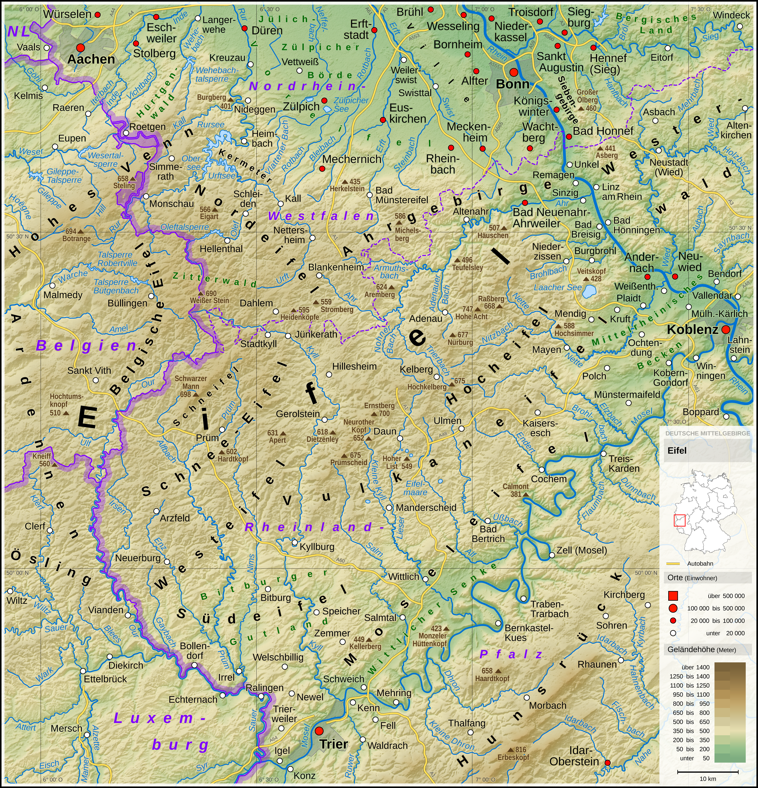
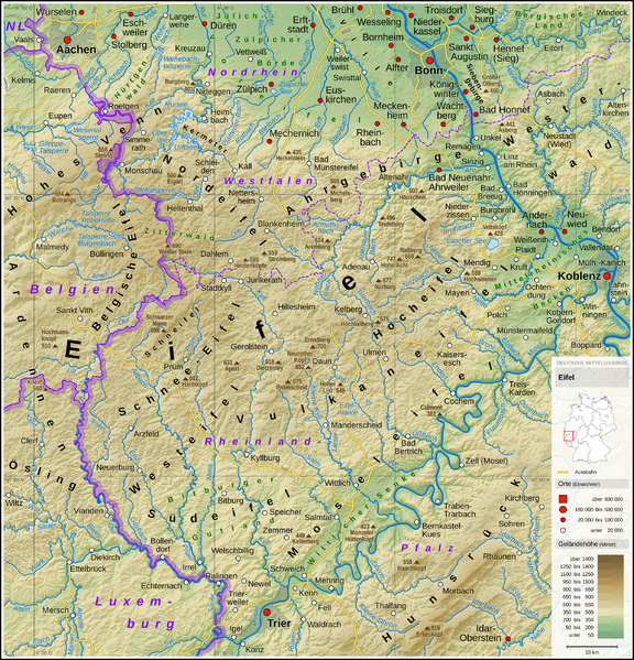
English: Topographic map of the Eifel
Deutsch: Topografische Karte der Eifel |
||||||||||||||||||
| Data | |||||||||||||||||||
| Origine |
Own work using: |
||||||||||||||||||
| Autor | Thoroe | ||||||||||||||||||
| Altere versiones |
 Topographic maps of German low mountain ranges (A series)
This map series aims to show the major low mountain ranges of Germany in a uniform design. All maps are created on the same scale, and the background reliefs base upon the same color scheme. The reliefs are also available as separate files. You can find the making-of one of the maps in the German language Wikipedia (German only).
|
||||||||||||||||||


_-_Deutsche_Mittelgebirge,_Serie_A-de.png)
_-_Deutsche_Mittelgebirge,_Serie_A-de.png)
_-_Deutsche_Mittelgebirge,_Serie_A-de.png)
_-_Deutsche_Mittelgebirge,_Serie_A-de.png)
_-_Deutsche_Mittelgebirge,_Serie_A-de.png)
_-_Deutsche_Mittelgebirge,_Serie_A-de.png)
_-_Deutsche_Mittelgebirge,_Serie_A-de.png)
_-_Deutsche_Mittelgebirge,_Serie_A-de.png)
_-_Deutsche_Mittelgebirge,_Serie_A-de.png)
_-_Deutsche_Mittelgebirge,_Serie_A-de.png)
_-_Deutsche_Mittelgebirge,_Serie_A-de.png)
_-_Deutsche_Mittelgebirge,_Serie_A-de.png)
_-_Deutsche_Mittelgebirge,_Serie_A-de.png)
_-_Deutsche_Mittelgebirge,_Serie_A-de.png)
_-_Deutsche_Mittelgebirge,_Serie_A-de.png)
_-_Deutsche_Mittelgebirge,_Serie_A-de.png)
_-_Deutsche_Mittelgebirge,_Serie_A-de.png)
_-_Deutsche_Mittelgebirge,_Serie_A-de.png)
_-_Deutsche_Mittelgebirge,_Serie_A-de.png)
_-_Deutsche_Mittelgebirge,_Serie_A-de.png)
_-_Deutsche_Mittelgebirge,_Serie_A-de.png)
_-_Deutsche_Mittelgebirge,_Serie_A-de.png)
_-_Deutsche_Mittelgebirge,_Serie_A-de.png)
_-_Deutsche_Mittelgebirge,_Serie_A-de.png)
_-_Deutsche_Mittelgebirge,_Serie_A-de.png)
_-_Deutsche_Mittelgebirge,_Serie_A-de.png)
_-_Deutsche_Mittelgebirge,_Serie_A-de.png)
_-_Deutsche_Mittelgebirge,_Serie_A-de.png)
_-_Deutsche_Mittelgebirge,_Serie_A-de.png)
_-_Deutsche_Mittelgebirge,_Serie_A-de.png)
_-_Deutsche_Mittelgebirge,_Serie_A-de.png)
_-_Deutsche_Mittelgebirge,_Serie_A-de.png)
| This work contains information from OpenStreetMap, which is made available under the Open Database License (ODbL).
The ODbL does not require any particular license for maps produced from ODbL data. Prior to 1 August 2020, map tiles produced by the OpenStreetMap Foundation were licensed under the CC-BY-SA-2.0 license. Maps produced by other people may be subject to other licences. |

|
This map has been made or improved in the German Kartenwerkstatt (Map Lab). You can propose maps to improve as well.
|
Licentia
- Tu es libere:
- de condivider – de copiar, distribuer e transmitter le obra
- de remixar – de adaptar le obra
- Sub le sequente conditiones:
- attribution – Tu debe dar information appropriate sur le autor, fornir un ligamine al licentia, e indicar si modificationes ha essite apportate. Tu pote facer lo de qualcunque maniera rationabile, ma non in alcun modo que suggere que le licentiator approba te o tu uso del obra.
- condivider equalmente – Si tu altera, transforma o disveloppa le material, tu debe distribuer tu contributiones sub un licentia identic o compatibile con le original.
| Annotations | This image is annotated: View the annotations at Commons |
Historia del file
Clicca sur un data/hora pro vider le file como appareva a ille tempore.
| Data/Hora | Miniatura | Dimensiones | Usator | Commento | |
|---|---|---|---|---|---|
| actual | 10:53, 13 maio 2017 | | 2 500 × 2 600 (9,83 MB) | Thoroe | Brohlbach (Mosel) korr. |
| 23:05, 10 maio 2017 |  | 2 500 × 2 600 (9,82 MB) | Thoroe | + Stadtkyll | |
| 13:56, 7 maio 2017 |  | 2 500 × 2 600 (9,82 MB) | Thoroe | 1st revision | |
| 20:37, 4 maio 2017 |  | 2 500 × 2 600 (9,82 MB) | Thoroe | {{Information |Description ={{en|1=Topographic map of the Eifel}} {{de|1=Topografische Karte der Eifel}} |Source ={{Own using}} *[http://gmt.soest.hawaii.edu Generic Mapping Tools (GMT)] with [http://dds.cr.usgs.g... |
Uso de iste file
Le sequente pagina usa iste file:
Uso global de iste file
Le altere wikis sequente usa iste imagine:
- Uso in arz.wikipedia.org
- Uso in bn.wikipedia.org
- Uso in ca.wikipedia.org
- Uso in da.wikipedia.org
- Uso in de.wikipedia.org
- Eifel
- Vulkaneifel
- Wittlicher Senke
- Winterspelt (Andersch)
- Schneifel
- Östliche Hocheifel
- Ahrgebirge
- Rureifel
- Nordeifel
- Südeifel
- Zitterwald
- Portal:Eifel
- Kermeter
- Hürtgenwald (Forst)
- Wikipedia:Kartenwerkstatt/Kartenwünsche
- Moseleifel
- Liste von Bergen und Erhebungen der Eifel
- Voreifel
- Liste der naturräumlichen Einheiten in Rheinland-Pfalz
- Benutzer:Thoroe
- Bitburger Gutland
- Wikipedia:Kartenwerkstatt/Archiv/2017-05
- Prümscheid (Naturraum)
- Benutzer:Thoroe/Making of Thüringer Wald
- Uso in de.wiktionary.org
- Uso in el.wikipedia.org
- Uso in en.wikipedia.org
- Uso in en.wikivoyage.org
- Uso in eo.wikipedia.org
- Uso in es.wikipedia.org
- Uso in et.wikipedia.org
- Uso in fa.wikipedia.org
- Uso in fi.wikipedia.org
- Uso in frr.wikipedia.org
- Uso in fr.wikipedia.org
Vider altere usos global de iste file.