
File:CHN orthographic.svg

Dimension de iste previsualisation PNG de iste file SVG: 550 × 550 pixels. Altere resolutiones: 240 × 240 pixels | 480 × 480 pixels | 768 × 768 pixels | 1 024 × 1 024 pixels | 2 048 × 2 048 pixels.
File original (File SVG, dimensiones nominal: 550 × 550 pixels, grandor del file: 1,46 MB)
Summario
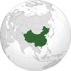
| Description | China orthographic map |
| Data |
|
| Origine |
Obra proprie |
| Autor |
Addicted04 |
.svg)
.svg)
.svg)
.svg)
.svg)
.svg)
.svg)
.svg)
.svg)
.svg)
.svg)
.svg)
.svg)
.svg)
.svg)
.svg)
.svg)
.svg)
.svg)
.svg)
.svg)
.svg)
.svg)
.svg)
.svg)
.svg)
.svg)
.svg)
.svg)
.svg)
.svg)
.svg)
.svg)
.svg)
.svg)
.svg)
.svg)
.svg)
.svg)
.svg)
.svg)
.svg)
.svg)
.svg)
.svg)
.svg)
.svg)
.svg)
.svg)
.svg)
.svg)
.svg)
.svg)
.svg)
.svg)
.svg)
.svg)
.svg)
.svg)
.svg)
.svg)
.svg)
.svg)
.svg)
.svg)
.svg)
.svg)
.svg)
.svg)
.svg)
.svg)
.svg)
.svg)
.svg)

.svg)

.svg)

.svg)
.svg)
.svg)
.svg)
.svg)
.svg)
.svg)


.svg)
.svg)
.svg)
.svg)
.svg)
.svg)
.svg)

.svg)
.svg)
.svg)
.svg)
.svg)
.svg)
.svg)
.svg)
.svg)

.svg)
.svg)
.svg)
.svg)
.svg)
.svg)
.svg)
_without_national_boundaries.svg)
.svg)
.svg)
.svg)
.svg)
.svg)
.svg)

.svg)
.svg)
.png)
.svg)
.svg)
.svg)
.svg)

.svg)
.svg)
.svg)
.svg)
.svg)
.svg)
.svg)
.svg)
.svg)
.svg)
.svg)

.svg)
.svg)
.svg)
.svg)
.svg)
.svg)
.svg)
.svg)
.svg)

.svg)
.svg)

.svg)
.svg)
.svg)
.svg)
.svg)
.svg)
.svg)
.svg)
.svg)
.svg)
.svg)
.svg)
.svg)
.svg)
.svg)
.svg)
.svg)
.svg)
.svg)
.svg)
.svg)
.svg)
.svg)
.svg)
.svg)
.svg)
.svg)
_-_Crimea_disputed.svg)
.svg)
.svg)
.svg)
.svg)
.svg)
.svg)
.svg)
.svg)
.svg)
.svg)
.svg)
_political.svg)
.svg)
.svg)
.svg)
.svg)
_-_Crimea_disputed_-_no_borders.svg)
.svg)
.svg)
.svg)
.svg)
.svg)
.svg)
.svg)
.svg)
.svg)
.svg)
.svg)

.svg)
.svg)
.svg)

.png)
.svg)
.svg)
.svg)
.svg)
.svg)
.svg)
.svg)
.svg)
.svg)
.svg)
.svg)
.svg)
.svg)
.svg)
.svg)
.svg)
.svg)
.svg)
.svg)
.svg)
.svg)
.svg)
.svg)
.svg)
.svg)
.svg)
.svg)
.svg)
.svg)
.svg)
.svg)
.svg)
.svg)
.svg)
.png)
.svg)
.svg)
.svg)
_(orthographic_projection).png)
| Orthographic projections maps created by Ssolbergj |
|---|
| Orthographic projections maps created by Ssolbergj: |
.svg)
.svg)
| Annotations | This image is annotated: View the annotations at Commons |
Licentia
Io, titular del derecto de autor sur iste obra, declara de publicar lo sub le sequente licentia:
Iste file es disponibile sub le licentia Creative Commons Attribution-CompartiSimile 3.0 Non-localisate.
- Tu es libere:
- de condivider – de copiar, distribuer e transmitter le obra
- de remixar – de adaptar le obra
- Sub le sequente conditiones:
- attribution – Tu debe dar information appropriate sur le autor, fornir un ligamine al licentia, e indicar si modificationes ha essite apportate. Tu pote facer lo de qualcunque maniera rationabile, ma non in alcun modo que suggere que le licentiator approba te o tu uso del obra.
- condivider equalmente – Si tu altera, transforma o disveloppa le material, tu debe distribuer tu contributiones sub un licentia identic o compatibile con le original.

|
WARNING! According to Chinese Law, producing, selling and advertising maps or other items, both in electronic and print versions, that do not conform to the territorial claims of the Chinese government is prohibited. |
Historia del file
Clicca sur un data/hora pro vider le file como appareva a ille tempore.
| Data/Hora | Miniatura | Dimensiones | Usator | Commento | |
|---|---|---|---|---|---|
| actual | 06:04, 11 februario 2020 | | 550 × 550 (1,46 MB) | 芄蘭 | Reverted to version as of 14:28, 31 July 2019 (UTC) |
| 13:02, 10 februario 2020 |  | 720 × 722 (334 KB) | Abhishek65628 | Reverted to version as of 15:44, 25 July 2019 (UTC) | |
| 14:28, 31 julio 2019 |  | 550 × 550 (1,46 MB) | The Account 1 | Reverted to version as of 22:59, 22 October 2011 (UTC) China still claims Arunachal Pradesh | |
| 15:44, 25 julio 2019 |  | 720 × 722 (334 KB) | Lakshmisreekanth | Updated image | |
| 22:59, 22 octobre 2011 |  | 550 × 550 (1,46 MB) | Addicted04 | claimed color | |
| 22:03, 22 octobre 2011 |  | 550 × 550 (1,46 MB) | Addicted04 |
Uso de iste file
Le sequente 3 paginas usa iste file:
Uso global de iste file
Le altere wikis sequente usa iste imagine:
- Uso in am.wikipedia.org
- Uso in ar.wikipedia.org
- الصين
- مستخدم:جار الله/قائمة صور مقالات العلاقات الثنائية
- العلاقات الأنغولية الصينية
- العلاقات الصينية الكورية الجنوبية
- العلاقات الصينية الإريترية
- العلاقات الصينية السويسرية
- العلاقات الألمانية الصينية
- العلاقات الصينية الليختنشتانية
- العلاقات الصينية البوليفية
- العلاقات الصينية الموزمبيقية
- العلاقات الصينية البلجيكية
- العلاقات الصينية الإثيوبية
- العلاقات الصينية البيلاروسية
- العلاقات الصينية الطاجيكية
- العلاقات الصينية الروسية منذ عام 1991
- العلاقات الصينية الرومانية
- العلاقات الأرجنتينية الصينية
- العلاقات الصينية الغامبية
- العلاقات الصينية القبرصية
- العلاقات الصينية السيراليونية
- العلاقات الصينية النيبالية
- العلاقات الصينية الليبيرية
- العلاقات التشيكية الصينية
- العلاقات الصينية الميانمارية
- العلاقات الصينية الزيمبابوية
- العلاقات الصينية البالاوية
- العلاقات الصينية المالية
- العلاقات الصينية النيجيرية
- العلاقات الصينية الفانواتية
- العلاقات الصينية الغابونية
- العلاقات الصينية البنمية
- العلاقات الصينية الكوبية
- العلاقات الصينية الجورجية
- العلاقات التونسية الصينية
- العلاقات الصينية الهندية
- العلاقات الصينية الإيطالية
- العلاقات الصينية الناوروية
- العلاقات الأسترالية الصينية
- العلاقات الزامبية الصينية
- العلاقات الصينية الفيجية
- العلاقات الصينية المارشالية
- العلاقات الأذربيجانية الصينية
- العلاقات الصينية الكونغوية
- العلاقات الصينية الدومينيكانية
- العلاقات البرازيلية الصينية
- العلاقات الصينية الغرينادية
- العلاقات الصينية الكازاخستانية
- العلاقات الصينية الكوستاريكية
- العلاقات الصينية الصربية
Vider altere usos global de iste file.