
File:BlankEurope.png

Dimension de iste previsualisation: 595 × 599 pixels.Altere resolutiones: 238 × 240 pixels | 477 × 480 pixels | 762 × 768 pixels | 1 236 × 1 245 pixels.
File original (1 236 × 1 245 pixels, dimension del file: 78 KB, typo MIME: image/png)

|
File:Blank map of Europe (with disputed regions).svg is a vector version of this file. It should be used in place of this PNG file when not inferior.
File:BlankEurope.png → File:Blank map of Europe (with disputed regions).svg
For more information, see Help:SVG. |
.svg) |
Summario
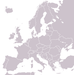
A blank political map of Europe extracted from Image:European Union member states by number of houses.png. +Hexagon1 (t) 04:47, 26 November 2006 (UTC)
Other versions: if you wish to use a map to show historical information before 2008, use Image:BlankEurope-BeforeKosovo.png
Licentia

|
Le permission es concedite de copiar, distribuer e/o modificar iste documento sub le conditiones del Licentia GNU pro Documentation Libere, Version 1.2 o omne version plus recente publicate per le Fundation pro Software Libere; sin Sectiones Invariabile, sin Textos de Copertura Frontal e sin Textos de Copertura Posterior. Un copia del licentia es includite in le section titulate Licentia GNU pro Documentation Libere. |
| Iste file es disponibile sub le licentia Creative Commons Attribution-CompartiSimile 3.0 Non-localisate. | ||
| ||
| Iste etiquetta de licentia esseva addite a iste file como parte del actualisation del licentia GFDL. |
Historia del file
Clicca sur un data/hora pro vider le file como appareva a ille tempore.
| Data/Hora | Miniatura | Dimensiones | Usator | Commento | |
|---|---|---|---|---|---|
| actual | 13:31, 26 septembre 2022 | | 1 236 × 1 245 (78 KB) | BlackShadowG | Reverted to version as of 14:55, 27 October 2008 (UTC) |
| 22:40, 23 februario 2009 |  | 1 236 × 1 245 (78 KB) | Avala | ||
| 14:55, 27 octobre 2008 |  | 1 236 × 1 245 (78 KB) | Quilbert | Reverted to version as of 05:53, 5 April 2008 – there is already Image:BlankEurope-BeforeKosovo.png | |
| 18:13, 24 octobre 2008 |  | 1 236 × 1 245 (78 KB) | Avala | ||
| 05:53, 5 april 2008 |  | 1 236 × 1 245 (78 KB) | Hoshie | redid microstates, beefed up Spanish N. Africa, SBAs, and Gibraltar | |
| 18:42, 25 februario 2008 |  | 1 236 × 1 245 (78 KB) | Hoshie | fixed Gibraltar, Ceuta and Melilla, and the SBAs | |
| 02:39, 24 februario 2008 |  | 1 236 × 1 245 (78 KB) | Hoshie | Added Kosovo since it has been internationally recognized | |
| 22:40, 3 januario 2008 |  | 1 236 × 1 245 (78 KB) | Hoshie | Re-drew ESBA and WSBA with circles until I study the CIA maps, boundary between Gibraltar and Spain. | |
| 04:47, 26 novembre 2006 |  | 1 236 × 1 245 (44 KB) | Happenstance | A blank map of Europe extracted from Image:European Union member states by number of houses.png. ~~~~ |
Uso de iste file
Il non ha paginas que usa iste file.
Uso global de iste file
Le altere wikis sequente usa iste imagine:
- Uso in de.wiktionary.org
- Uso in hu.wikipedia.org
- Uso in incubator.wikimedia.org
- Uso in it.wiktionary.org
- Uso in sl.wiktionary.org
- Uso in uk.wikipedia.org